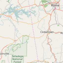
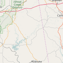
Haralson County Georgia Map and Data
Haralson County Georgia Profile and Data
| Name | Haralson County |
| State | Georgia |
| FIPS Code | 13143 |
| County Seat | Buchanan |
| Timezone | Eastern Daylight Time (EDT) |
| Population (2022) | 28,627 |
| Population Growth Rate(2000-2022) | 3.96% |
| Majority Ethnicity | White 94.53% |
| Public School Majority Ethnicity | White 89% |
| Partisan Voting Index | Strongly Republican:+38 |
| Unemployment Rate (February 2025) | 3.1% |
| Area Code(s) | 470 / 678 / 770 / 943 |
Haralson County Race/Ethnicity Data
| Race/Ethnicity | Percentage of Population (2022) |
|---|---|
| White | 94.53% |
| African American | 4.84% |
| Hispanic | 0% |
| Asian | 0.63% |
| Native American | 0% |
| Hawaiin/Pacific Islander | 0% |
Haralson County Public School Race/Ethnicity Data
| Race/Ethnicity | Percentage of Public School Students (2023) |
|---|---|
| White | 88.76% |
| African American | 3.44% |
| Hispanic | 2.97% |
| Asian | 0.83% |
| Native American | 0.28% |
| Hawaiin/Pacific Islander | 0.21% |