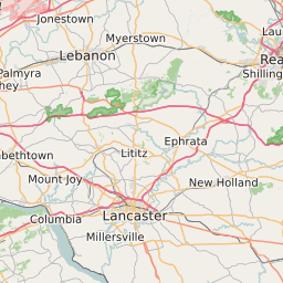
Lancaster County Pennsylvania Map and Data


Lancaster County Pennsylvania Profile and Data
| Name | Lancaster County |
| State | Pennsylvania |
| FIPS Code | 42071 |
| County Seat | Lancaster |
| Timezone | Eastern Daylight Time (EDT) |
| Population (2022) | 519,913 |
| Population Growth Rate(2000-2022) | 6.46% |
| Majority Ethnicity | White 92.74% |
| Public School Majority Ethnicity | White 63% |
| Partisan Voting Index | Republican:+9 |
| Unemployment Rate (February 2025) | 2.6% |
| Area Code(s) | 223 / 717 / 484 / 610 / 835 |
Lancaster County Race/Ethnicity Data
| Race/Ethnicity | Percentage of Population (2022) |
|---|---|
| White | 92.74% |
| African American | 4.43% |
| Hispanic | 0.18% |
| Asian | 2.61% |
| Native American | 0.02% |
| Hawaiin/Pacific Islander | 0.02% |
Lancaster County Public School Race/Ethnicity Data
| Race/Ethnicity | Percentage of Public School Students (2023) |
|---|---|
| White | 63.28% |
| African American | 6.01% |
| Hispanic | 22.06% |
| Asian | 3.45% |
| Native American | 0.12% |
| Hawaiin/Pacific Islander | 0.05% |