United States Unemployment Level Heat Map - June 2025
United States
Unemployment Rate:4.2%
Highest State:
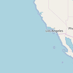
California, CA5.0%
Lowest State:
South Dakota, SD1.8%
Highest County:
Skagway-Hoonah-Angoon Census Area, AK18.7%
Lowest County:
Brule County, SD1.2%
Highest City:
Delano, CA25.3%
Lowest City:
Northville, MI1.6%
| Over 15% | 10-15% | 8-10% | 6-8% | 4-6% | 2-4% | 0-2% |


Alabama: 2.7%
Quick Stats
| Highest City | Prichard | 5.9% |
| Lowest City | Vestavia Hills | 1.8% |
| Highest County | Greene County | 6.3% |
| Lowest County | Shelby County | 2.1% |
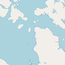
Alaska: 4.8%
Quick Stats
| Highest City | Wrangell | 5.3% |
| Lowest City | Sitka | 3.5% |
| Highest County | Skagway-Hoonah-Angoon Census Area | 18.7% |
| Lowest County | Aleutians West Census Area | 2.7% |
Arizona: 3.5%
Quick Stats
| Highest City | San Luis | 20.4% |
| Lowest City | Gilbert | 2.5% |
| Highest County | Yuma County | 11.3% |
| Lowest County | Greenlee County | 2.1% |
Arkansas: 3.2%
Quick Stats
| Highest City | West Memphis | 5.5% |
| Lowest City | Bentonville | 2.3% |
| Highest County | Desha County | 6.3% |
| Lowest County | Benton County | 2.5% |
California: 5.0%
Quick Stats
| Highest City | Delano | 25.3% |
| Lowest City | Goleta | 2.8% |
| Highest County | Imperial County | 16.0% |
| Lowest County | Mono County | 3.2% |
Colorado: 4.6%
Quick Stats
| Highest City | Pueblo | 6.4% |
| Lowest City | Lafayette | 4.2% |
| Highest County | Mineral County | 8.8% |
| Lowest County | Yuma County | 2.7% |
Connecticut: 3.4%
Quick Stats
| Highest City | Waterbury | 5.7% |
| Lowest City | Glastonbury | 2.5% |
| Highest County | New London County | 7.6% |
| Lowest County | None | 5.4% |
Delaware: 3.9%
Quick Stats
| Highest City | Wilmington | 5.4% |
| Lowest City | Newark | 4.1% |
| Highest County | Kent County | 4.2% |
| Lowest County | New Castle County | 3.8% |
District of Columbia: 5.8%
Quick Stats
Florida: 3.5%
Quick Stats
| Highest City | Fort Pierce | 5.1% |
| Lowest City | Key West | 2.2% |
| Highest County | Sumter County | 6.3% |
| Lowest County | Monroe County | 2.4% |
Georgia: 3.1%
Quick Stats
| Highest City | Albany | 4.6% |
| Lowest City | Brookhaven | 2.2% |
| Highest County | Quitman County | 6.7% |
| Lowest County | Wheeler County | 2.0% |
Idaho: 3.5%
Quick Stats
| Highest City | Post Falls | 4.5% |
| Lowest City | Moscow | 2.5% |
| Highest County | Adams County | 8.9% |
| Lowest County | Teton County | 2.4% |
Illinois: 4.5%
Quick Stats
| Highest City | Maywood | 8.9% |
| Lowest City | Quincy | 2.6% |
| Highest County | Cook County | 5.4% |
| Lowest County | Monroe County | 2.1% |
Indiana: 3.0%
Quick Stats
| Highest City | Gary | 7.6% |
| Lowest City | Zionsville | 2.0% |
| Highest County | Howard County | 6.0% |
| Lowest County | Daviess County | 2.1% |
Iowa: 3.2%
Quick Stats
| Highest City | Marshalltown | 6.5% |
| Lowest City | West Des Moines | 2.7% |
| Highest County | Marshall County | 5.8% |
| Lowest County | Osceola County | 2.2% |
Kansas: 3.7%
Quick Stats
| Highest City | Emporia | 5.2% |
| Lowest City | Garden City | 2.7% |
| Highest County | Mitchell County | 5.1% |
| Lowest County | Sheridan County | 2.4% |
Kentucky: 4.4%
Quick Stats
| Highest City | Ashland | 5.2% |
| Lowest City | Georgetown | 3.2% |
| Highest County | Martin County | 9.3% |
| Lowest County | Woodford County | 3.1% |
Louisiana: 4.0%
Quick Stats
| Highest City | Monroe | 5.7% |
| Lowest City | Central | 3.1% |
| Highest County | East Carroll Parish | 13.1% |
| Lowest County | West Feliciana Parish | 2.8% |
Maine: 3.4%
Quick Stats
| Highest City | Lewiston | 3.8% |
| Lowest City | South Portland | 2.5% |
| Highest County | None | 6.3% |
| Lowest County | None | 2.6% |
Maryland: 3.0%
Quick Stats
| Highest City | College Park | 4.5% |
| Lowest City | Annapolis | 2.5% |
| Highest County | Allegany County | 4.4% |
| Lowest County | Carroll County | 2.3% |
Massachusetts: 4.6%
Quick Stats
| Highest City | Fall River | 7.1% |
| Lowest City | Amherst | 2.1% |
| Highest County | Nantucket County | 8.6% |
| Lowest County | None | 4.0% |
Michigan: 4.7%
Quick Stats
| Highest City | Flint | 14.0% |
| Lowest City | Northville | 1.6% |
| Highest County | Mackinac County | 17.9% |
| Lowest County | Livingston County | 2.7% |
Minnesota: 3.2%
Quick Stats
| Highest City | Brooklyn Center | 3.8% |
| Lowest City | Moorhead | 2.3% |
| Highest County | Clearwater County | 8.8% |
| Lowest County | Rock County | 1.8% |
Mississippi: 3.5%
Quick Stats
| Highest City | Greenville | 5.5% |
| Lowest City | Madison | 2.4% |
| Highest County | Issaquena County | 10.8% |
| Lowest County | Lafayette County | 2.5% |
Missouri: 3.8%
Quick Stats
| Highest City | Grandview | 4.6% |
| Lowest City | O'Fallon | 3.0% |
| Highest County | Hickory County | 6.6% |
| Lowest County | Nodaway County | 2.7% |
Montana: 2.7%
Quick Stats
| Highest City | Anaconda-Deer Lodge County | 3.0% |
| Lowest City | Bozeman | 2.0% |
| Highest County | Lincoln County | 5.4% |
| Lowest County | Fallon County | 1.6% |
Nebraska: 2.9%
Quick Stats
| Highest City | Omaha | 3.3% |
| Lowest City | Kearney | 2.4% |
| Highest County | Hooker County | 5.7% |
| Lowest County | Boone County | 2.0% |
Nevada: 5.0%
Quick Stats
| Highest City | North Las Vegas | 5.5% |
| Lowest City | Carson City | 4.0% |
| Highest County | Mineral County | 9.0% |
| Lowest County | Elko County | 3.6% |
New Hampshire: 2.9%
Quick Stats
| Highest City | Derry | 3.7% |
| Lowest City | Dover | 2.1% |
| Highest County | None | 3.2% |
| Lowest County | None | 2.4% |
New Jersey: 4.7%
Quick Stats
| Highest City | Atlantic City | 9.1% |
| Lowest City | Hoboken | 2.5% |
| Highest County | Cape May County | 9.4% |
| Lowest County | Hunterdon County | 3.6% |
New Mexico: 3.5%
Quick Stats
| Highest City | Roswell | 3.5% |
| Lowest City | Carlsbad | 2.6% |
| Highest County | Luna County | 13.0% |
| Lowest County | Los Alamos County | 1.4% |
New York: 3.6%
Quick Stats
| Highest City | New York | 4.6% |
| Lowest City | Bethlehem | 2.1% |
| Highest County | None | 6.1% |
| Lowest County | Putnam County | 2.4% |
North Carolina: 3.4%
Quick Stats
| Highest City | Rocky Mount | 5.6% |
| Lowest City | Apex | 2.6% |
| Highest County | Edgecombe County | 4.9% |
| Lowest County | Camden County | 2.7% |
North Dakota: 2.5%
Quick Stats
| Highest City | Fargo | 2.7% |
| Lowest City | Grand Forks | 2.1% |
| Highest County | Emmons County | 5.0% |
| Lowest County | Dickey County | 1.7% |
Ohio: 4.9%
Quick Stats
| Highest City | Warren | 8.4% |
| Lowest City | Brunswick | 3.5% |
| Highest County | Ottawa County | 7.4% |
| Lowest County | Holmes County | 3.5% |
Oklahoma: 2.5%
Quick Stats
| Highest City | Muskogee | 3.7% |
| Lowest City | Moore | 2.1% |
| Highest County | Love County | 4.0% |
| Lowest County | Dewey County | 1.4% |
Oregon: 4.1%
Quick Stats
| Highest City | Grants Pass | 5.0% |
| Lowest City | Corvallis | 3.1% |
| Highest County | Grant County | 7.1% |
| Lowest County | Benton County | 3.1% |
Pennsylvania: 3.5%
Quick Stats
| Highest City | York | 4.8% |
| Lowest City | Cranberry | 1.9% |
| Highest County | Forest County | 5.1% |
| Lowest County | Centre County | 2.5% |
Puerto Rico: 5.3%
Quick Stats
| Highest County | Maricao Municipio | 25.0% |
| Lowest County | Culebra Municipio | 1.3% |
Rhode Island: 4.4%
Quick Stats
| Highest City | Woonsocket | 5.9% |
| Lowest City | South Kingstown | 3.3% |
| Highest County | None | 4.8% |
| Lowest County | None | 3.4% |
South Carolina: 3.8%
Quick Stats
| Highest City | Sumter | 5.1% |
| Lowest City | Mount Pleasant | 2.7% |
| Highest County | Marlboro County | 6.4% |
| Lowest County | Charleston County | 3.0% |
South Dakota: 1.8%
Quick Stats
| Highest City | Aberdeen | 1.9% |
| Lowest City | Rapid City | 1.7% |
| Highest County | Todd County | 4.3% |
| Lowest County | Brule County | 1.2% |
Tennessee: 2.9%
Quick Stats
| Highest City | Memphis | 4.1% |
| Lowest City | Franklin | 2.1% |
| Highest County | Johnson County | 5.1% |
| Lowest County | Williamson County | 2.2% |
Texas: 3.7%
Quick Stats
| Highest City | Eagle Pass | 11.5% |
| Lowest City | Kyle | 2.6% |
| Highest County | Maverick County | 10.6% |
| Lowest County | Upton County | 1.2% |
Utah: 3.0%
Quick Stats
| Highest City | Ogden | 3.7% |
| Lowest City | Syracuse | 2.4% |
| Highest County | Garfield County | 6.4% |
| Lowest County | Cache County | 2.5% |
Vermont: 2.7%
Quick Stats
| Highest City | Burlington | 1.9% |
| Lowest City | Burlington | 1.9% |
| Highest County | None | 5.1% |
| Lowest County | None | 2.1% |
Virginia: 3.3%
Quick Stats
| Highest City | Emporia | 6.8% |
| Lowest City | Leesburg | 2.8% |
| Highest County | None | 6.8% |
| Lowest County | Cumberland County | 2.7% |
Washington: 4.2%
Quick Stats
| Highest City | Yakima | 5.2% |
| Lowest City | Pullman | 3.1% |
| Highest County | Ferry County | 6.6% |
| Lowest County | Asotin County | 2.8% |
West Virginia: 3.5%
Quick Stats
| Highest City | Parkersburg | 3.9% |
| Lowest City | Morgantown | 2.7% |
| Highest County | McDowell County | 7.7% |
| Lowest County | Jefferson County | 2.5% |
Wisconsin: 3.3%
Quick Stats
| Highest City | Racine | 4.7% |
| Lowest City | Fitchburg | 2.1% |
| Highest County | Iron County | 7.2% |
| Lowest County | Calumet County | 2.5% |
Wyoming: 3.0%
Quick Stats
| Highest City | Gillette | 3.1% |
| Lowest City | Laramie | 2.3% |
| Highest County | Big Horn County | 3.9% |
| Lowest County | Johnson County | 2.2% |