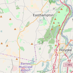
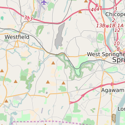
Map of Hampden County Precinct Level Results for the 2020 Presidential Election
D 80-100% |
D 70-80% |
D 60-70% |
D 45-60% |
R 45-60% |
R 60-70% |
R 70-80% |
R 80-100% |
List of Hampden County Precinct Level Results for the 2020 Presidential Election | ||||||||
|---|---|---|---|---|---|---|---|---|
| Map Index | Precinct | City/Town | ZIP Code | Joe Biden Democrat | Donald Trump Republican | Jo Jorgensen Libertarian | ||
| Agawam Town Precinct 1 | Agawam Town | 01030 | 825 (46.72%) | 922 (52.21%) | 19 (1.08%) | |||
| Agawam Town Precinct 2 | Agawam Town | 01030 | 1036 (47.46%) | 1121 (51.35%) | 26 (1.19%) | |||
| Agawam Town Precinct 3 | Agawam Town | 01030 | 1022 (48.97%) | 1041 (49.88%) | 24 (1.15%) | |||
| Agawam Town Precinct 4 | Agawam Town | 01089 | 848 (49.59%) | 836 (48.89%) | 26 (1.52%) | |||
| Agawam Town Precinct 5 | Agawam Town | 01001 | 1131 (50.88%) | 1074 (48.31%) | 18 (0.81%) | |||
| Agawam Town Precinct 6 | Agawam Town | 01001 | 930 (48.72%) | 954 (49.97%) | 25 (1.31%) | |||
| Agawam Town Precinct 7 | Agawam Town | 01030 | 910 (45.21%) | 1074 (53.35%) | 29 (1.44%) | |||
| Agawam Town Precinct 8 | Agawam Town | 01001 | 1092 (50.51%) | 1051 (48.61%) | 19 (0.88%) | |||
| Blandford Town Precinct 1 | Blandford | 01011 | 307 (39.66%) | 454 (58.66%) | 13 (1.68%) | |||
| Brimfield Town Precinct 1 | 01069 | 1063 (46.22%) | 1193 (51.87%) | 44 (1.91%) | ||||
| Chester Town Precinct 1 | Chester | 01050 | 313 (42.18%) | 415 (55.93%) | 14 (1.89%) | |||
| Chicopee City Ward 1 Precinct A | Chicopee | 01013 | 818 (54.83%) | 654 (43.83%) | 20 (1.34%) | |||
| Chicopee City Ward 1 Precinct B | Chicopee | 01022 | 1020 (56.04%) | 775 (42.58%) | 25 (1.37%) | |||
| Chicopee City Ward 2 Precinct A | Chicopee | 01013 | 646 (64.92%) | 339 (34.07%) | 10 (1.01%) | |||
| Chicopee City Ward 2 Precinct B | Chicopee | 01013 | 910 (53.81%) | 757 (44.77%) | 24 (1.42%) | |||
| Chicopee City Ward 3 Precinct A | Chicopee | 01013 | 755 (54.71%) | 610 (44.2%) | 15 (1.09%) | |||
| Chicopee City Ward 3 Precinct B | Chicopee | 01013 | 650 (57.17%) | 465 (40.9%) | 22 (1.93%) | |||
| Chicopee City Ward 4 Precinct A | Chicopee | 01013 | 788 (60.38%) | 499 (38.24%) | 18 (1.38%) | |||
| Chicopee City Ward 4 Precinct B | Chicopee | 01020 | 797 (62.9%) | 447 (35.28%) | 23 (1.82%) | |||
| Chicopee City Ward 5 Precinct A | Chicopee | 01020 | 886 (60.52%) | 554 (37.84%) | 24 (1.64%) | |||
| Chicopee City Ward 5 Precinct B | Chicopee | 01020 | 767 (57.8%) | 539 (40.62%) | 21 (1.58%) | |||
| Chicopee City Ward 6 Precinct AN | Chicopee | 01022 | 243 (62.47%) | 140 (35.99%) | 6 (1.54%) | |||
| Chicopee City Ward 6 Precinct AS | Chicopee | 01020 | 485 (55.05%) | 389 (44.15%) | 7 (0.79%) | |||
| Chicopee City Ward 6 Precinct BE | Chicopee | 01020 | 690 (45.54%) | 803 (53%) | 22 (1.45%) | |||
| Chicopee City Ward 6 Precinct BW | Chicopee | 01020 | 175 (51.32%) | 161 (47.21%) | 5 (1.47%) | |||
| Chicopee City Ward 7 Precinct A | Chicopee | 01020 | 649 (60.82%) | 402 (37.68%) | 16 (1.5%) | |||
| Chicopee City Ward 7 Precinct B | Chicopee | 01013 | 802 (63.55%) | 439 (34.79%) | 21 (1.66%) | |||
| Chicopee City Ward 8 Precinct A | Chicopee | 01020 | 855 (56.07%) | 628 (41.18%) | 42 (2.75%) | |||
| Chicopee City Ward 8 Precinct B | Chicopee | 01020 | 738 (54.26%) | 602 (44.26%) | 20 (1.47%) | |||
| Chicopee City Ward 9 Precinct A | Chicopee | 01020 | 846 (56.21%) | 631 (41.93%) | 28 (1.86%) | |||
| Chicopee City Ward 9 Precinct B | Chicopee | 01020 | 982 (54.19%) | 802 (44.26%) | 28 (1.55%) | |||
| East Longmeadow Town Precinct 1 | 01028 | 1420 (55.3%) | 1122 (43.69%) | 26 (1.01%) | ||||
| East Longmeadow Town Precinct 2 | 01028 | 1274 (54.8%) | 1025 (44.09%) | 26 (1.12%) | ||||
| East Longmeadow Town Precinct 3 | 01028 | 1330 (52.36%) | 1180 (46.46%) | 30 (1.18%) | ||||
| East Longmeadow Town Precinct 4 | 01036 | 1271 (48.81%) | 1296 (49.77%) | 37 (1.42%) | ||||
| Granville Town Precinct 1 | 01071 | 402 (40.73%) | 565 (57.24%) | 20 (2.03%) | ||||
| Hampden Town Precinct 1 | 01057 | 1539 (46.5%) | 1713 (51.75%) | 58 (1.75%) | ||||
| Holland Town Precinct 1 | Holland | 01010 | 698 (45.65%) | 793 (51.86%) | 38 (2.49%) | |||
| Holyoke City Ward 1 Precinct A | Holyoke | 01040 | 448 (70%) | 190 (29.69%) | 2 (0.31%) | |||
| Holyoke City Ward 1 Precinct B | Holyoke | 01040 | 583 (74.36%) | 193 (24.62%) | 8 (1.02%) | |||
| Holyoke City Ward 2 Precinct A | Holyoke | 01040 | 547 (71.78%) | 211 (27.69%) | 4 (0.52%) | |||
| Holyoke City Ward 2 Precinct B | Holyoke | 01040 | 493 (71.87%) | 188 (27.41%) | 5 (0.73%) | |||
| Holyoke City Ward 3 Precinct A | Holyoke | 01040 | 857 (70.94%) | 334 (27.65%) | 17 (1.41%) | |||
| Holyoke City Ward 3 Precinct B | Holyoke | 01040 | 948 (65.29%) | 489 (33.68%) | 15 (1.03%) | |||
| Holyoke City Ward 4 Precinct A | Holyoke | 01040 | 481 (74.34%) | 159 (24.57%) | 7 (1.08%) | |||
| Holyoke City Ward 4 Precinct B | Holyoke | 01040 | 754 (74.51%) | 247 (24.41%) | 11 (1.09%) | |||
| Holyoke City Ward 5 Precinct A | Holyoke | 01040 | 1120 (58.06%) | 783 (40.59%) | 26 (1.35%) | |||
| Holyoke City Ward 5 Precinct B | Holyoke | 01040 | 807 (61.98%) | 485 (37.25%) | 10 (0.77%) | |||
| Holyoke City Ward 6 Precinct A | Holyoke | 01040 | 786 (73.39%) | 268 (25.02%) | 17 (1.59%) | |||
| Holyoke City Ward 6 Precinct B | Holyoke | 01040 | 949 (71.03%) | 373 (27.92%) | 14 (1.05%) | |||
| Holyoke City Ward 7 Precinct A | Holyoke | 01040 | 1235 (68.27%) | 559 (30.9%) | 15 (0.83%) | |||
| Holyoke City Ward 7 Precinct B | Holyoke | 01040 | 1144 (74.97%) | 364 (23.85%) | 18 (1.18%) | |||
| Longmeadow Town Precinct A | Longmeadow | 01106 | 1425 (67.82%) | 649 (30.89%) | 27 (1.29%) | |||
| Longmeadow Town Precinct B | Longmeadow | 01106 | 1263 (66.61%) | 604 (31.86%) | 29 (1.53%) | |||
| Longmeadow Town Precinct C | Longmeadow | 01106 | 1378 (62.47%) | 794 (35.99%) | 34 (1.54%) | |||
| Longmeadow Town Precinct D | Longmeadow | 01106 | 1241 (62.02%) | 730 (36.48%) | 30 (1.5%) | |||
| Longmeadow Town Precinct E | Longmeadow | 01106 | 1372 (64.99%) | 716 (33.92%) | 23 (1.09%) | |||
| Ludlow Town Precinct 1 | 01056 | 968 (48.67%) | 996 (50.08%) | 25 (1.26%) | ||||
| Ludlow Town Precinct 2 | 01056 | 776 (54.04%) | 648 (45.13%) | 12 (0.84%) | ||||
| Ludlow Town Precinct 3 | 01056 | 942 (42.05%) | 1276 (56.96%) | 22 (0.98%) | ||||
| Ludlow Town Precinct 4 | 01056 | 945 (50.32%) | 908 (48.35%) | 25 (1.33%) | ||||
| Ludlow Town Precinct 5 | 01033 | 717 (48.28%) | 746 (50.24%) | 22 (1.48%) | ||||
| Ludlow Town Precinct 6 | 01056 | 1119 (49.49%) | 1121 (49.58%) | 21 (0.93%) | ||||
| Monson Town Precinct A | Monson Center | 01069 | 791 (46.97%) | 871 (51.72%) | 22 (1.31%) | |||
| Monson Town Precinct B | 01036 | 815 (47.83%) | 851 (49.94%) | 38 (2.23%) | ||||
| Monson Town Precinct C | Monson Center | 01069 | 840 (48.19%) | 866 (49.68%) | 37 (2.12%) | |||
| Montgomery Town Precinct 1 | 01071 | 246 (43.77%) | 312 (55.52%) | 4 (0.71%) | ||||
| Palmer Town Precinct 1 | Palmer Town | 01009 | 768 (48.48%) | 797 (50.32%) | 19 (1.2%) | |||
| Palmer Town Precinct 1A | Palmer Town | 01069 | 109 (49.55%) | 107 (48.64%) | 4 (1.82%) | |||
| Palmer Town Precinct 2 | Palmer Town | 01010 | 802 (45.85%) | 923 (52.77%) | 24 (1.37%) | |||
| Palmer Town Precinct 3 | Palmer Town | 01069 | 750 (54.74%) | 594 (43.36%) | 26 (1.9%) | |||
| Palmer Town Precinct 4 | Palmer Town | 01095 | 679 (44.47%) | 819 (53.63%) | 29 (1.9%) | |||
| Russell Town Precinct 1 | Russell | 01008 | 366 (40.4%) | 512 (56.51%) | 28 (3.09%) | |||
| Southwick Town Precinct 1 | 01034 | 811 (38.42%) | 1265 (59.92%) | 35 (1.66%) | ||||
| Southwick Town Precinct 2 | 01077 | 713 (42.11%) | 939 (55.46%) | 41 (2.42%) | ||||
| Southwick Town Precinct 3 | 01077 | 836 (44.56%) | 1017 (54.21%) | 23 (1.23%) | ||||
| Springfield City Ward 1 Precinct A | Springfield | 01107 | 371 (71.07%) | 148 (28.35%) | 3 (0.57%) | |||
| Springfield City Ward 1 Precinct B | Springfield | 01107 | 542 (78.21%) | 145 (20.92%) | 6 (0.87%) | |||
| Springfield City Ward 1 Precinct C | Springfield | 01107 | 368 (75.1%) | 115 (23.47%) | 7 (1.43%) | |||
| Springfield City Ward 1 Precinct D | Springfield | 01104 | 483 (79.97%) | 115 (19.04%) | 6 (0.99%) | |||
| Springfield City Ward 1 Precinct E | Springfield | 01107 | 533 (74.75%) | 172 (24.12%) | 8 (1.12%) | |||
| Springfield City Ward 1 Precinct F | Springfield | 01104 | 463 (79.69%) | 115 (19.79%) | 3 (0.52%) | |||
| Springfield City Ward 1 Precinct G | Springfield | 01105 | 542 (81.02%) | 120 (17.94%) | 7 (1.05%) | |||
| Springfield City Ward 1 Precinct H | Springfield | 01144 | 557 (82.15%) | 115 (16.96%) | 6 (0.88%) | |||
| Springfield City Ward 2 Precinct A | Springfield | 01104 | 526 (77.47%) | 150 (22.09%) | 3 (0.44%) | |||
| Springfield City Ward 2 Precinct B | Springfield | 01104 | 718 (72.09%) | 269 (27.01%) | 9 (0.9%) | |||
| Springfield City Ward 2 Precinct C | Springfield | 01104 | 518 (72.14%) | 190 (26.46%) | 10 (1.39%) | |||
| Springfield City Ward 2 Precinct D | Springfield | 01104 | 712 (71.41%) | 271 (27.18%) | 14 (1.4%) | |||
| Springfield City Ward 2 Precinct E | Springfield | 01104 | 642 (67.01%) | 303 (31.63%) | 13 (1.36%) | |||
| Springfield City Ward 2 Precinct F | Springfield | 01104 | 796 (73.84%) | 279 (25.88%) | 3 (0.28%) | |||
| Springfield City Ward 2 Precinct G | Springfield | 01104 | 792 (67.63%) | 368 (31.43%) | 11 (0.94%) | |||
| Springfield City Ward 2 Precinct H | Springfield | 01104 | 691 (70.51%) | 283 (28.88%) | 6 (0.61%) | |||
| Springfield City Ward 3 Precinct A | Springfield | 01105 | 433 (81.85%) | 93 (17.58%) | 3 (0.57%) | |||
| Springfield City Ward 3 Precinct B | Springfield | 01105 | 401 (79.88%) | 94 (18.73%) | 7 (1.39%) | |||
| Springfield City Ward 3 Precinct C | Springfield | 01105 | 325 (77.57%) | 89 (21.24%) | 5 (1.19%) | |||
| Springfield City Ward 3 Precinct D | Springfield | 01105 | 460 (80.7%) | 106 (18.6%) | 4 (0.7%) | |||
| Springfield City Ward 3 Precinct E | Springfield | 01108 | 366 (77.87%) | 101 (21.49%) | 3 (0.64%) | |||
| Springfield City Ward 3 Precinct F | Springfield | 01108 | 405 (75.56%) | 124 (23.13%) | 7 (1.31%) | |||
| Springfield City Ward 3 Precinct G | Springfield | 01108 | 356 (76.72%) | 101 (21.77%) | 7 (1.51%) | |||
| Springfield City Ward 3 Precinct H | Springfield | 01108 | 476 (75.56%) | 154 (24.44%) | 0 (0%) | |||
| Springfield City Ward 4 Precinct A | Springfield | 01109 | 718 (88.42%) | 88 (10.84%) | 6 (0.74%) | |||
| Springfield City Ward 4 Precinct B | Springfield | 01109 | 673 (85.19%) | 115 (14.56%) | 2 (0.25%) | |||
| Springfield City Ward 4 Precinct C | Springfield | 01109 | 504 (86.6%) | 75 (12.89%) | 3 (0.52%) | |||
| Springfield City Ward 4 Precinct D | Springfield | 01109 | 582 (88.72%) | 69 (10.52%) | 5 (0.76%) | |||
| Springfield City Ward 4 Precinct E | Springfield | 01109 | 525 (89.59%) | 60 (10.24%) | 1 (0.17%) | |||
| Springfield City Ward 4 Precinct F | Springfield | 01109 | 196 (87.89%) | 25 (11.21%) | 2 (0.9%) | |||
| Springfield City Ward 4 Precinct G | Springfield | 01104 | 646 (85.9%) | 99 (13.16%) | 7 (0.93%) | |||
| Springfield City Ward 4 Precinct H | Springfield | 01109 | 616 (91.12%) | 55 (8.14%) | 5 (0.74%) | |||
| Springfield City Ward 5 Precinct A | Springfield | 01109 | 640 (85.79%) | 98 (13.14%) | 8 (1.07%) | |||
| Springfield City Ward 5 Precinct B | Springfield | 01109 | 804 (78.9%) | 210 (20.61%) | 5 (0.49%) | |||
| Springfield City Ward 5 Precinct C | Springfield | 01119 | 615 (71.93%) | 233 (27.25%) | 7 (0.82%) | |||
| Springfield City Ward 5 Precinct D | Springfield | 01129 | 794 (63.27%) | 446 (35.54%) | 15 (1.2%) | |||
| Springfield City Ward 5 Precinct E | Springfield | 01119 | 972 (80.66%) | 225 (18.67%) | 8 (0.66%) | |||
| Springfield City Ward 5 Precinct F | Springfield | 01119 | 845 (75.92%) | 256 (23%) | 12 (1.08%) | |||
| Springfield City Ward 5 Precinct G | Springfield | 01119 | 864 (62.56%) | 504 (36.5%) | 13 (0.94%) | |||
| Springfield City Ward 5 Precinct H | Springfield | 01119 | 600 (64.94%) | 317 (34.31%) | 7 (0.76%) | |||
| Springfield City Ward 6 Precinct A | Springfield | 01108 | 550 (78.57%) | 145 (20.71%) | 5 (0.71%) | |||
| Springfield City Ward 6 Precinct B | Springfield | 01001 | 792 (74.3%) | 263 (24.67%) | 11 (1.03%) | |||
| Springfield City Ward 6 Precinct C | Springfield | 01108 | 638 (68.02%) | 249 (26.55%) | 51 (5.44%) | |||
| Springfield City Ward 6 Precinct D | Springfield | 01108 | 783 (62.49%) | 459 (36.63%) | 11 (0.88%) | |||
| Springfield City Ward 6 Precinct E | Springfield | 01108 | 511 (73.63%) | 178 (25.65%) | 5 (0.72%) | |||
| Springfield City Ward 6 Precinct F | Springfield | 01108 | 601 (77.35%) | 169 (21.75%) | 7 (0.9%) | |||
| Springfield City Ward 6 Precinct G | Springfield | 01108 | 669 (73.36%) | 236 (25.88%) | 7 (0.77%) | |||
| Springfield City Ward 6 Precinct H | Springfield | 01118 | 711 (67.27%) | 338 (31.98%) | 8 (0.76%) | |||
| Springfield City Ward 7 Precinct A | Springfield | 01118 | 772 (67.13%) | 367 (31.91%) | 11 (0.96%) | |||
| Springfield City Ward 7 Precinct B | Springfield | 01118 | 876 (64.84%) | 459 (33.97%) | 16 (1.18%) | |||
| Springfield City Ward 7 Precinct C | Springfield | 01118 | 866 (66.06%) | 435 (33.18%) | 10 (0.76%) | |||
| Springfield City Ward 7 Precinct D | Springfield | 01118 | 740 (60.96%) | 455 (37.48%) | 19 (1.57%) | |||
| Springfield City Ward 7 Precinct E | Springfield | 01128 | 618 (74.01%) | 207 (24.79%) | 10 (1.2%) | |||
| Springfield City Ward 7 Precinct F | Springfield | 01118 | 831 (64.92%) | 432 (33.75%) | 17 (1.33%) | |||
| Springfield City Ward 7 Precinct G | Springfield | 01129 | 820 (59.25%) | 551 (39.81%) | 13 (0.94%) | |||
| Springfield City Ward 7 Precinct H | Springfield | 01119 | 396 (67.81%) | 176 (30.14%) | 12 (2.05%) | |||
| Springfield City Ward 8 Precinct A | Springfield | 01151 | 669 (66.17%) | 332 (32.84%) | 10 (0.99%) | |||
| Springfield City Ward 8 Precinct B | Springfield | 01119 | 741 (73.66%) | 256 (25.45%) | 9 (0.89%) | |||
| Springfield City Ward 8 Precinct C | Springfield | 01109 | 711 (77.7%) | 193 (21.09%) | 11 (1.2%) | |||
| Springfield City Ward 8 Precinct D | Springfield | 01151 | 412 (71.9%) | 151 (26.35%) | 10 (1.75%) | |||
| Springfield City Ward 8 Precinct E | Springfield | 01151 | 490 (71.22%) | 192 (27.91%) | 6 (0.87%) | |||
| Springfield City Ward 8 Precinct F | Springfield | 01151 | 691 (68.48%) | 310 (30.72%) | 8 (0.79%) | |||
| Springfield City Ward 8 Precinct G | Springfield | 01119 | 692 (68.65%) | 300 (29.76%) | 16 (1.59%) | |||
| Springfield City Ward 8 Precinct H | Springfield | 01119 | 711 (76.78%) | 209 (22.57%) | 6 (0.65%) | |||
| Tolland Town Precinct 1 | 01034 | 136 (41.59%) | 186 (56.88%) | 5 (1.53%) | ||||
| Wales Town Precinct 1 | 01010 | 429 (39.94%) | 619 (57.64%) | 26 (2.42%) | ||||
| West Springfield Town Precinct 1 | West Springfield Town | 01089 | 519 (56.6%) | 386 (42.09%) | 12 (1.31%) | |||
| West Springfield Town Precinct 2 | West Springfield Town | 01089 | 705 (59.09%) | 474 (39.73%) | 14 (1.17%) | |||
| West Springfield Town Precinct 3 | West Springfield Town | 01107 | 850 (56.25%) | 636 (42.09%) | 25 (1.65%) | |||
| West Springfield Town Precinct 4 | West Springfield Town | 01089 | 966 (56.49%) | 718 (41.99%) | 26 (1.52%) | |||
| West Springfield Town Precinct 5 | West Springfield Town | 01030 | 1162 (51.12%) | 1076 (47.34%) | 35 (1.54%) | |||
| West Springfield Town Precinct 6 | West Springfield Town | 01089 | 1033 (49.78%) | 1024 (49.35%) | 18 (0.87%) | |||
| West Springfield Town Precinct 7 | West Springfield Town | 01089 | 1053 (47.5%) | 1130 (50.97%) | 34 (1.53%) | |||
| West Springfield Town Precinct 8 | West Springfield Town | 01013 | 869 (57.51%) | 623 (41.23%) | 19 (1.26%) | |||
| Westfield City Ward 1 Precinct A | Westfield | 01085 | 1030 (48.68%) | 1055 (49.86%) | 31 (1.47%) | |||
| Westfield City Ward 1 Precinct B | Westfield | 01085 | 868 (46%) | 968 (51.3%) | 51 (2.7%) | |||
| Westfield City Ward 2 Precinct A | Westfield | 01085 | 655 (58.74%) | 445 (39.91%) | 15 (1.35%) | |||
| Westfield City Ward 2 Precinct B | Westfield | 01085 | 808 (53.72%) | 660 (43.88%) | 36 (2.39%) | |||
| Westfield City Ward 3 Precinct A | Westfield | 01085 | 587 (54.91%) | 448 (41.91%) | 34 (3.18%) | |||
| Westfield City Ward 3 Precinct B | Westfield | 01085 | 934 (54.94%) | 722 (42.47%) | 44 (2.59%) | |||
| Westfield City Ward 4 Precinct A | Westfield | 01085 | 322 (47.85%) | 338 (50.22%) | 13 (1.93%) | |||
| Westfield City Ward 4 Precinct B | Westfield | 01085 | 1129 (49.41%) | 1119 (48.97%) | 37 (1.62%) | |||
| Westfield City Ward 5 Precinct A | Westfield | 01077 | 1122 (48.68%) | 1128 (48.94%) | 55 (2.39%) | |||
| Westfield City Ward 5 Precinct B | Westfield | 01085 | 1019 (45.84%) | 1163 (52.32%) | 41 (1.84%) | |||
| Westfield City Ward 6 Precinct A | Westfield | 01073 | 911 (46.1%) | 1022 (51.72%) | 43 (2.18%) | |||
| Westfield City Ward 6 Precinct B | Westfield | 01085 | 815 (50.22%) | 790 (48.68%) | 18 (1.11%) | |||
| Wilbraham Town Precinct A | Wilbraham | 01095 | 1300 (54.37%) | 1056 (44.17%) | 35 (1.46%) | |||
| Wilbraham Town Precinct B | 01129 | 1247 (54.81%) | 998 (43.87%) | 30 (1.32%) | ||||
| Wilbraham Town Precinct C | Wilbraham | 01095 | 1139 (49.8%) | 1119 (48.93%) | 29 (1.27%) | |||
| Wilbraham Town Precinct D | 01036 | 1242 (52.36%) | 1089 (45.91%) | 41 (1.73%) | ||||


