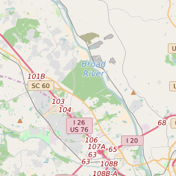
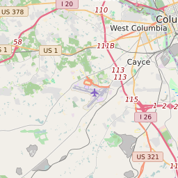
Map of Richland County Precinct Level Results for the 2020 Presidential Election
D 80-100% |
D 70-80% |
D 60-70% |
D 45-60% |
R 45-60% |
R 60-70% |
R 70-80% |
R 80-100% |
List of Richland County Precinct Level Results for the 2020 Presidential Election | ||||||||||
|---|---|---|---|---|---|---|---|---|---|---|
| Map Index | Precinct | City/Town | ZIP Code | Joe Biden Democrat | Donald Trump Republican | Jo Jorgensen Libertarian | Howie Hawkins Green | Rocky De La Fuente Reform | ||
| Arcadia | Forest Acres | 29206 | 743 (60.65%) | 449 (36.65%) | 25 (2.04%) | 6 (0.49%) | 2 (0.16%) | |||
| Ardincaple | Columbia | 29203 | 312 (95.41%) | 12 (3.67%) | 1 (0.31%) | 2 (0.61%) | 0 (0%) | |||
| Ballentine 1 | Lake Murray of Richland | 29063 | 502 (39.65%) | 736 (58.14%) | 26 (2.05%) | 1 (0.08%) | 1 (0.08%) | |||
| Ballentine 2 | Irmo | 29212 | 494 (30.65%) | 1093 (67.8%) | 16 (0.99%) | 4 (0.25%) | 5 (0.31%) | |||
| Beatty Road | St. Andrews | 29210 | 470 (87.85%) | 59 (11.03%) | 1 (0.19%) | 4 (0.75%) | 1 (0.19%) | |||
| Bluff | Columbia | 29209 | 1280 (94.67%) | 58 (4.29%) | 6 (0.44%) | 6 (0.44%) | 2 (0.15%) | |||
| Blythewood 1 | Blythewood | 29016 | 772 (41.64%) | 1060 (57.17%) | 16 (0.86%) | 6 (0.32%) | 0 (0%) | |||
| Blythewood 2 | Blythewood | 29130 | 989 (50.95%) | 924 (47.6%) | 18 (0.93%) | 5 (0.26%) | 5 (0.26%) | |||
| Blythewood 3 | Blythewood | 29016 | 1460 (64.01%) | 792 (34.72%) | 23 (1.01%) | 5 (0.22%) | 1 (0.04%) | |||
| Bookman | 29229 | 1599 (66.79%) | 756 (31.58%) | 31 (1.29%) | 6 (0.25%) | 2 (0.08%) | ||||
| Brandon 1 | Capitol View | 29209 | 1152 (76.09%) | 344 (22.72%) | 14 (0.92%) | 3 (0.2%) | 1 (0.07%) | |||
| Brandon 2 | Columbia | 29209 | 1203 (85.14%) | 188 (13.31%) | 15 (1.06%) | 6 (0.42%) | 1 (0.07%) | |||
| Briarwood | Dentsville | 29223 | 1466 (78.61%) | 384 (20.59%) | 11 (0.59%) | 2 (0.11%) | 2 (0.11%) | |||
| Bridge Creek | 29229 | 1389 (80.62%) | 318 (18.46%) | 12 (0.7%) | 3 (0.17%) | 1 (0.06%) | ||||
| Caughman Road | 29061 | 1151 (75.67%) | 359 (23.6%) | 9 (0.59%) | 1 (0.07%) | 1 (0.07%) | ||||
| College Place | Columbia | 29203 | 923 (95.65%) | 38 (3.94%) | 1 (0.1%) | 3 (0.31%) | 0 (0%) | |||
| Cooper | Forest Acres | 29206 | 483 (48.01%) | 506 (50.3%) | 14 (1.39%) | 2 (0.2%) | 1 (0.1%) | |||
| Dennyside | Columbia | 29203 | 454 (61.6%) | 258 (35.01%) | 17 (2.31%) | 5 (0.68%) | 3 (0.41%) | |||
| Dentsville | Columbia | 29223 | 1405 (90.94%) | 121 (7.83%) | 10 (0.65%) | 8 (0.52%) | 1 (0.06%) | |||
| Dutch Fork 1 | 29063 | 352 (32.09%) | 722 (65.82%) | 18 (1.64%) | 4 (0.36%) | 1 (0.09%) | ||||
| Dutch Fork 2 | Irmo | 29063 | 595 (50.6%) | 564 (47.96%) | 14 (1.19%) | 3 (0.26%) | 0 (0%) | |||
| Dutch Fork 3 | 29036 | 776 (37.93%) | 1237 (60.46%) | 30 (1.47%) | 2 (0.1%) | 1 (0.05%) | ||||
| Dutch Fork 4 | 29063 | 645 (43.67%) | 802 (54.3%) | 28 (1.9%) | 0 (0%) | 2 (0.14%) | ||||
| East Forest Acres | Forest Acres | 29206 | 493 (42.46%) | 649 (55.9%) | 16 (1.38%) | 2 (0.17%) | 1 (0.09%) | |||
| Eastover | Gadsden | 29052 | 850 (90.43%) | 84 (8.94%) | 3 (0.32%) | 2 (0.21%) | 1 (0.11%) | |||
| Edgewood | Columbia | 29203 | 989 (94.82%) | 43 (4.12%) | 2 (0.19%) | 8 (0.77%) | 1 (0.1%) | |||
| Estates | 29045 | 1033 (62.49%) | 590 (35.69%) | 24 (1.45%) | 6 (0.36%) | 0 (0%) | ||||
| Fairlawn | 29016 | 1831 (83.19%) | 337 (15.31%) | 22 (1%) | 8 (0.36%) | 3 (0.14%) | ||||
| Fairwold | Columbia | 29203 | 585 (97.66%) | 11 (1.84%) | 2 (0.33%) | 1 (0.17%) | 0 (0%) | |||
| Friarsgate 1 | Irmo | 29063 | 773 (58.43%) | 513 (38.78%) | 27 (2.04%) | 9 (0.68%) | 1 (0.08%) | |||
| Friarsgate 2 | Irmo | 29063 | 624 (55.22%) | 480 (42.48%) | 16 (1.42%) | 10 (0.88%) | 0 (0%) | |||
| Gadsden | Gadsden | 29044 | 1009 (93.25%) | 67 (6.19%) | 4 (0.37%) | 2 (0.18%) | 0 (0%) | |||
| Garners | 29044 | 388 (60.91%) | 237 (37.21%) | 10 (1.57%) | 0 (0%) | 2 (0.31%) | ||||
| Greenview | Columbia | 29203 | 1170 (96.77%) | 28 (2.32%) | 2 (0.17%) | 7 (0.58%) | 2 (0.17%) | |||
| Gregg Park | Forest Acres | 29206 | 836 (60.01%) | 538 (38.62%) | 12 (0.86%) | 3 (0.22%) | 4 (0.29%) | |||
| Hampton | Columbia | 29205 | 807 (68.39%) | 332 (28.14%) | 27 (2.29%) | 11 (0.93%) | 3 (0.25%) | |||
| Harbison 1 | St. Andrews | 29063 | 1172 (73.85%) | 387 (24.39%) | 25 (1.58%) | 3 (0.19%) | 0 (0%) | |||
| Harbison 2 | St. Andrews | 29210 | 712 (71.2%) | 276 (27.6%) | 7 (0.7%) | 4 (0.4%) | 1 (0.1%) | |||
| Hopkins 1 | Hopkins | 29209 | 945 (88.65%) | 110 (10.32%) | 9 (0.84%) | 2 (0.19%) | 0 (0%) | |||
| Hopkins 2 | Hopkins | 29044 | 1119 (87.15%) | 152 (11.84%) | 6 (0.47%) | 6 (0.47%) | 1 (0.08%) | |||
| Horrell Hill | 29044 | 985 (57.57%) | 712 (41.61%) | 9 (0.53%) | 4 (0.23%) | 1 (0.06%) | ||||
| Hunting Creek | 29061 | 220 (56.27%) | 167 (42.71%) | 2 (0.51%) | 1 (0.26%) | 1 (0.26%) | ||||
| Keels 1 | Dentsville | 29223 | 1150 (87.19%) | 159 (12.05%) | 7 (0.53%) | 3 (0.23%) | 0 (0%) | |||
| Keels 2 | Dentsville | 29223 | 883 (92.46%) | 55 (5.76%) | 9 (0.94%) | 6 (0.63%) | 2 (0.21%) | |||
| Keenan | Forest Acres | 29223 | 961 (71.99%) | 346 (25.92%) | 18 (1.35%) | 6 (0.45%) | 4 (0.3%) | |||
| Kelly Mill | 29229 | 1159 (64.78%) | 613 (34.26%) | 11 (0.61%) | 4 (0.22%) | 2 (0.11%) | ||||
| Killian | 29203 | 1669 (76.7%) | 481 (22.1%) | 19 (0.87%) | 3 (0.14%) | 4 (0.18%) | ||||
| Kingswood | Columbia | 29210 | 1717 (85.04%) | 282 (13.97%) | 12 (0.59%) | 8 (0.4%) | 0 (0%) | |||
| Lake Carolina | 29229 | 1633 (64.9%) | 852 (33.86%) | 25 (0.99%) | 4 (0.16%) | 2 (0.08%) | ||||
| Lincolnshire | 29203 | 1339 (96.12%) | 41 (2.94%) | 3 (0.22%) | 10 (0.72%) | 0 (0%) | ||||
| Longcreek | 29016 | 2333 (56.3%) | 1744 (42.08%) | 46 (1.11%) | 18 (0.43%) | 3 (0.07%) | ||||
| Longleaf | 29016 | 1238 (89%) | 141 (10.14%) | 5 (0.36%) | 7 (0.5%) | 0 (0%) | ||||
| Lykesland | Capitol View | 29209 | 1075 (73.48%) | 368 (25.15%) | 10 (0.68%) | 4 (0.27%) | 6 (0.41%) | |||
| Mallet Hill | Columbia | 29229 | 1361 (69.83%) | 567 (29.09%) | 13 (0.67%) | 7 (0.36%) | 1 (0.05%) | |||
| Mcentire | 29061 | 411 (62.27%) | 243 (36.82%) | 3 (0.45%) | 2 (0.3%) | 1 (0.15%) | ||||
| Meadowfield | Columbia | 29209 | 705 (50.72%) | 647 (46.55%) | 21 (1.51%) | 15 (1.08%) | 2 (0.14%) | |||
| Meadowlake | Columbia | 29203 | 1425 (94.31%) | 68 (4.5%) | 7 (0.46%) | 11 (0.73%) | 0 (0%) | |||
| Midway | Dentsville | 29206 | 1574 (86.34%) | 234 (12.84%) | 7 (0.38%) | 7 (0.38%) | 1 (0.05%) | |||
| Mill Creek | Capitol View | 29209 | 751 (77.82%) | 197 (20.41%) | 10 (1.04%) | 7 (0.73%) | 0 (0%) | |||
| Monticello | 29180 | 833 (60.49%) | 530 (38.49%) | 11 (0.8%) | 3 (0.22%) | 0 (0%) | ||||
| North Forest Acres | Forest Acres | 29204 | 609 (59.36%) | 392 (38.21%) | 22 (2.14%) | 3 (0.29%) | 0 (0%) | |||
| North Springs 1 | 29223 | 699 (64.9%) | 360 (33.43%) | 12 (1.11%) | 4 (0.37%) | 2 (0.19%) | ||||
| North Springs 2 | 29229 | 1531 (66.25%) | 754 (32.63%) | 19 (0.82%) | 6 (0.26%) | 1 (0.04%) | ||||
| North Springs 3 | 29223 | 1270 (81.41%) | 262 (16.79%) | 18 (1.15%) | 6 (0.38%) | 4 (0.26%) | ||||
| Oak Pointe 1 | Columbia | 29063 | 580 (53.21%) | 485 (44.5%) | 17 (1.56%) | 6 (0.55%) | 2 (0.18%) | |||
| Oak Pointe 2 | 29063 | 303 (48.4%) | 311 (49.68%) | 11 (1.76%) | 0 (0%) | 1 (0.16%) | ||||
| Oak Pointe 3 | 29063 | 502 (58.92%) | 337 (39.55%) | 9 (1.06%) | 4 (0.47%) | 0 (0%) | ||||
| Oakwood | Forest Acres | 29206 | 463 (57.59%) | 330 (41.04%) | 9 (1.12%) | 2 (0.25%) | 0 (0%) | |||
| Old Friarsgate | Irmo | 29063 | 627 (60.46%) | 400 (38.57%) | 9 (0.87%) | 1 (0.1%) | 0 (0%) | |||
| Olympia | Columbia | 29205 | 843 (73.24%) | 274 (23.81%) | 24 (2.09%) | 8 (0.7%) | 2 (0.17%) | |||
| Parkridge 1 | Irmo | 29063 | 424 (57.84%) | 292 (39.84%) | 12 (1.64%) | 4 (0.55%) | 1 (0.14%) | |||
| Parkridge 2 | Columbia | 29212 | 424 (66.15%) | 212 (33.07%) | 4 (0.62%) | 0 (0%) | 1 (0.16%) | |||
| Parkway 1 | 29229 | 1445 (83.14%) | 266 (15.3%) | 15 (0.86%) | 11 (0.63%) | 1 (0.06%) | ||||
| Parkway 2 | 29229 | 1389 (76.19%) | 389 (21.34%) | 23 (1.26%) | 17 (0.93%) | 5 (0.27%) | ||||
| Parkway 3 | 29229 | 1351 (89.35%) | 146 (9.66%) | 8 (0.53%) | 3 (0.2%) | 4 (0.26%) | ||||
| Pennington 1 | Columbia | 29209 | 294 (31.92%) | 616 (66.88%) | 8 (0.87%) | 3 (0.33%) | 0 (0%) | |||
| Pennington 2 | Columbia | 29209 | 652 (53.01%) | 554 (45.04%) | 22 (1.79%) | 2 (0.16%) | 0 (0%) | |||
| Pine Grove | St. Andrews | 29210 | 957 (87.4%) | 126 (11.51%) | 7 (0.64%) | 5 (0.46%) | 0 (0%) | |||
| Pine Lakes 1 | 29209 | 815 (92.19%) | 64 (7.24%) | 4 (0.45%) | 1 (0.11%) | 0 (0%) | ||||
| Pine Lakes 2 | Columbia | 29061 | 1076 (90.88%) | 95 (8.02%) | 6 (0.51%) | 7 (0.59%) | 0 (0%) | |||
| Pinewood | 29061 | 1260 (85.6%) | 198 (13.45%) | 6 (0.41%) | 7 (0.48%) | 1 (0.07%) | ||||
| Polo Road | 29223 | 1401 (75.73%) | 426 (23.03%) | 14 (0.76%) | 9 (0.49%) | 0 (0%) | ||||
| Pontiac 1 | Columbia | 29078 | 1178 (58.4%) | 819 (40.6%) | 16 (0.79%) | 3 (0.15%) | 1 (0.05%) | |||
| Pontiac 2 | Columbia | 29045 | 1230 (61.29%) | 745 (37.12%) | 23 (1.15%) | 7 (0.35%) | 2 (0.1%) | |||
| Rice Creek 1 | 29229 | 1120 (83.9%) | 199 (14.91%) | 6 (0.45%) | 8 (0.6%) | 2 (0.15%) | ||||
| Rice Creek 2 | 29229 | 1839 (82.02%) | 378 (16.86%) | 14 (0.62%) | 7 (0.31%) | 4 (0.18%) | ||||
| Ridge View 1 | 29229 | 1665 (79.21%) | 409 (19.46%) | 19 (0.9%) | 8 (0.38%) | 1 (0.05%) | ||||
| Ridge View 2 | 29045 | 1868 (79.02%) | 469 (19.84%) | 20 (0.85%) | 6 (0.25%) | 1 (0.04%) | ||||
| Ridgewood | Columbia | 29203 | 442 (95.05%) | 19 (4.09%) | 3 (0.65%) | 1 (0.22%) | 0 (0%) | |||
| Riverside | St. Andrews | 29210 | 586 (79.3%) | 141 (19.08%) | 7 (0.95%) | 4 (0.54%) | 1 (0.14%) | |||
| Riversprings 1 | 29063 | 354 (35.79%) | 617 (62.39%) | 16 (1.62%) | 2 (0.2%) | 0 (0%) | ||||
| Riversprings 2 | 29063 | 625 (54.63%) | 495 (43.27%) | 20 (1.75%) | 3 (0.26%) | 1 (0.09%) | ||||
| Riversprings 3 | 29063 | 622 (47.7%) | 661 (50.69%) | 20 (1.53%) | 0 (0%) | 1 (0.08%) | ||||
| Riverwalk | Irmo | 29212 | 1428 (61.76%) | 848 (36.68%) | 29 (1.25%) | 6 (0.26%) | 1 (0.04%) | |||
| Round Top | 29016 | 362 (65.34%) | 187 (33.75%) | 4 (0.72%) | 0 (0%) | 1 (0.18%) | ||||
| Sandlapper | 29016 | 1941 (82.46%) | 391 (16.61%) | 15 (0.64%) | 6 (0.25%) | 1 (0.04%) | ||||
| Satchelford | Forest Acres | 29206 | 522 (45.39%) | 609 (52.96%) | 14 (1.22%) | 3 (0.26%) | 2 (0.17%) | |||
| Skyland | Columbia | 29210 | 518 (75.73%) | 149 (21.78%) | 9 (1.32%) | 8 (1.17%) | 0 (0%) | |||
| South Beltline | Columbia | 29209 | 680 (73.2%) | 228 (24.54%) | 17 (1.83%) | 4 (0.43%) | 0 (0%) | |||
| South Forest Acres | Forest Acres | 29204 | 607 (47.13%) | 659 (51.16%) | 12 (0.93%) | 6 (0.47%) | 4 (0.31%) | |||
| Spring Hill | 29063 | 455 (20.65%) | 1708 (77.53%) | 34 (1.54%) | 3 (0.14%) | 3 (0.14%) | ||||
| Spring Valley | 29223 | 1420 (63.42%) | 800 (35.73%) | 13 (0.58%) | 5 (0.22%) | 1 (0.04%) | ||||
| Spring Valley West | 29203 | 1643 (79.6%) | 389 (18.85%) | 14 (0.68%) | 14 (0.68%) | 4 (0.19%) | ||||
| Springville 1 | Lake Murray of Richland | 29036 | 519 (28.82%) | 1258 (69.85%) | 22 (1.22%) | 2 (0.11%) | 0 (0%) | |||
| Springville 2 | Lake Murray of Richland | 29063 | 440 (27.67%) | 1127 (70.88%) | 19 (1.19%) | 2 (0.13%) | 2 (0.13%) | |||
| St. Andrews | Columbia | 29210 | 623 (73.82%) | 204 (24.17%) | 15 (1.78%) | 1 (0.12%) | 1 (0.12%) | |||
| Trenholm Road | Forest Acres | 29223 | 382 (45.75%) | 442 (52.93%) | 7 (0.84%) | 2 (0.24%) | 2 (0.24%) | |||
| Trinity | Columbia | 29209 | 724 (68.89%) | 303 (28.83%) | 16 (1.52%) | 6 (0.57%) | 2 (0.19%) | |||
| Valhalla | Columbia | 29229 | 1032 (57.98%) | 722 (40.56%) | 19 (1.07%) | 6 (0.34%) | 1 (0.06%) | |||
| Valley State Park | 29229 | 2176 (88.78%) | 245 (10%) | 16 (0.65%) | 13 (0.53%) | 1 (0.04%) | ||||
| Walden | St. Andrews | 29212 | 618 (83.51%) | 113 (15.27%) | 5 (0.68%) | 4 (0.54%) | 0 (0%) | |||
| Ward 1 | Columbia | 29225 | 567 (71.5%) | 201 (25.35%) | 14 (1.77%) | 10 (1.26%) | 1 (0.13%) | |||
| Ward 10 | Columbia | 29205 | 767 (67.88%) | 342 (30.27%) | 14 (1.24%) | 6 (0.53%) | 1 (0.09%) | |||
| Ward 11 | Columbia | 29205 | 734 (76.7%) | 208 (21.73%) | 11 (1.15%) | 4 (0.42%) | 0 (0%) | |||
| Ward 12 | Columbia | 29205 | 780 (69.46%) | 325 (28.94%) | 9 (0.8%) | 9 (0.8%) | 0 (0%) | |||
| Ward 13 | Columbia | 29205 | 1083 (68.07%) | 475 (29.86%) | 27 (1.7%) | 5 (0.31%) | 1 (0.06%) | |||
| Ward 14 | Columbia | 29205 | 830 (64.49%) | 425 (33.02%) | 25 (1.94%) | 7 (0.54%) | 0 (0%) | |||
| Ward 15 | Columbia | 29204 | 492 (56.1%) | 372 (42.42%) | 10 (1.14%) | 2 (0.23%) | 1 (0.11%) | |||
| Ward 16 | Columbia | 29204 | 516 (45.79%) | 589 (52.26%) | 19 (1.69%) | 3 (0.27%) | 0 (0%) | |||
| Ward 17 | Columbia | 29205 | 699 (52.28%) | 620 (46.37%) | 11 (0.82%) | 5 (0.37%) | 2 (0.15%) | |||
| Ward 18 | Columbia | 29204 | 692 (85.64%) | 99 (12.25%) | 8 (0.99%) | 5 (0.62%) | 4 (0.5%) | |||
| Ward 19 | Columbia | 29203 | 719 (95.74%) | 19 (2.53%) | 7 (0.93%) | 6 (0.8%) | 0 (0%) | |||
| Ward 2 | Columbia | 29201 | 378 (80.43%) | 73 (15.53%) | 13 (2.77%) | 5 (1.06%) | 1 (0.21%) | |||
| Ward 20 | Columbia | 29203 | 1000 (80.19%) | 213 (17.08%) | 22 (1.76%) | 11 (0.88%) | 1 (0.08%) | |||
| Ward 21 | Columbia | 29203 | 971 (94.82%) | 43 (4.2%) | 5 (0.49%) | 5 (0.49%) | 0 (0%) | |||
| Ward 22 | Columbia | 29203 | 947 (93.67%) | 52 (5.14%) | 4 (0.4%) | 5 (0.49%) | 3 (0.3%) | |||
| Ward 23 | Columbia | 29205 | 508 (69.49%) | 213 (29.14%) | 7 (0.96%) | 3 (0.41%) | 0 (0%) | |||
| Ward 24 | Columbia | 29205 | 369 (44.09%) | 448 (53.52%) | 18 (2.15%) | 2 (0.24%) | 0 (0%) | |||
| Ward 25 | Columbia | 29206 | 482 (35.52%) | 843 (62.12%) | 26 (1.92%) | 5 (0.37%) | 1 (0.07%) | |||
| Ward 26 | Columbia | 29206 | 687 (68.43%) | 302 (30.08%) | 10 (1%) | 5 (0.5%) | 0 (0%) | |||
| Ward 29 | Columbia | 29203 | 826 (92.91%) | 53 (5.96%) | 5 (0.56%) | 3 (0.34%) | 2 (0.22%) | |||
| Ward 3 | Columbia | 29201 | 791 (73.99%) | 249 (23.29%) | 20 (1.87%) | 8 (0.75%) | 1 (0.09%) | |||
| Ward 30 | Columbia | 29201 | 500 (70.03%) | 195 (27.31%) | 14 (1.96%) | 5 (0.7%) | 0 (0%) | |||
| Ward 31 | Columbia | 29203 | 596 (95.97%) | 18 (2.9%) | 4 (0.64%) | 2 (0.32%) | 1 (0.16%) | |||
| Ward 32 | Columbia | 29204 | 566 (95.93%) | 11 (1.86%) | 7 (1.19%) | 3 (0.51%) | 3 (0.51%) | |||
| Ward 33 | Columbia | 29205 | 502 (79.43%) | 119 (18.83%) | 7 (1.11%) | 3 (0.47%) | 1 (0.16%) | |||
| Ward 34 | Columbia | 29204 | 572 (64.27%) | 303 (34.04%) | 13 (1.46%) | 2 (0.22%) | 0 (0%) | |||
| Ward 4 | Columbia | 29201 | 838 (74.56%) | 256 (22.78%) | 22 (1.96%) | 7 (0.62%) | 1 (0.09%) | |||
| Ward 5 | Columbia | 29201 | 378 (61.87%) | 214 (35.02%) | 17 (2.78%) | 2 (0.33%) | 0 (0%) | |||
| Ward 6 | Columbia | 29204 | 668 (62.9%) | 367 (34.56%) | 24 (2.26%) | 2 (0.19%) | 1 (0.09%) | |||
| Ward 7 | Columbia | 29203 | 626 (96.6%) | 15 (2.31%) | 2 (0.31%) | 4 (0.62%) | 1 (0.15%) | |||
| Ward 8 | Columbia | 29204 | 184 (95.83%) | 5 (2.6%) | 3 (1.56%) | 0 (0%) | 0 (0%) | |||
| Ward 9 | Columbia | 29204 | 485 (95.28%) | 20 (3.93%) | 2 (0.39%) | 2 (0.39%) | 0 (0%) | |||
| Webber | 29044 | 607 (71.58%) | 230 (27.12%) | 8 (0.94%) | 3 (0.35%) | 0 (0%) | ||||
| Westminster | St. Andrews | 29210 | 873 (85.5%) | 131 (12.83%) | 7 (0.69%) | 10 (0.98%) | 0 (0%) | |||
| Whitewell | St. Andrews | 29210 | 848 (86.97%) | 107 (10.97%) | 13 (1.33%) | 6 (0.62%) | 1 (0.1%) | |||
| Wildewood | 29229 | 1314 (54.96%) | 1048 (43.83%) | 21 (0.88%) | 5 (0.21%) | 3 (0.13%) | ||||
| Woodfield | Woodfield | 29223 | 1354 (76.02%) | 415 (23.3%) | 9 (0.51%) | 3 (0.17%) | 0 (0%) | |||
| Woodlands | Columbia | 29209 | 914 (46.59%) | 1011 (51.53%) | 28 (1.43%) | 9 (0.46%) | 0 (0%) | |||


