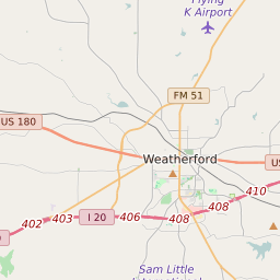
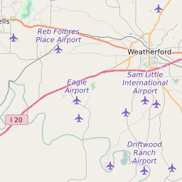
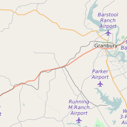
Map of Parker County Precinct Level Results for the 2020 Presidential Election
D 80-100% |
D 70-80% |
D 60-70% |
D 45-60% |
R 45-60% |
R 60-70% |
R 70-80% |
R 80-100% |
List of Parker County Precinct Level Results for the 2020 Presidential Election | |||||||||
|---|---|---|---|---|---|---|---|---|---|
| Map Index | Precinct | City/Town | ZIP Code | Joe Biden Democrat | Donald Trump Republican | Jo Jorgensen Libertarian | Howie Hawkins Green | ||
| 3670100 | Azle | 76085 | 661 (20.59%) | 2511 (78.2%) | 29 (0.9%) | 9 (0.28%) | |||
| 3670105 | Sanctuary | 76082 | 265 (15.99%) | 1367 (82.5%) | 20 (1.21%) | 5 (0.3%) | |||
| 3670110 | Azle | 76020 | 255 (19.84%) | 1007 (78.37%) | 19 (1.48%) | 3 (0.23%) | |||
| 3670111 | Azle | 76020 | 174 (17.61%) | 799 (80.87%) | 9 (0.91%) | 6 (0.61%) | |||
| 3670115 | Briar | 76023 | 340 (17.36%) | 1589 (81.11%) | 23 (1.17%) | 6 (0.31%) | |||
| 3670120 | Springtown | 76082 | 234 (14.78%) | 1323 (83.58%) | 22 (1.39%) | 4 (0.25%) | |||
| 3670125 | Reno (Parker County) | 76082 | 218 (10.54%) | 1833 (88.59%) | 13 (0.63%) | 4 (0.19%) | |||
| 3670130 | 76085 | 377 (15.41%) | 2040 (83.37%) | 26 (1.06%) | 3 (0.12%) | ||||
| 3670135 | Carter | 76085 | 212 (16.37%) | 1063 (82.08%) | 17 (1.31%) | 3 (0.23%) | |||
| 3670140 | Springtown | 76082 | 126 (13%) | 832 (85.86%) | 6 (0.62%) | 5 (0.52%) | |||
| 3670200 | Weatherford | 76085 | 238 (21.31%) | 864 (77.35%) | 14 (1.25%) | 1 (0.09%) | |||
| 3670205 | Weatherford | 76088 | 290 (22.87%) | 941 (74.21%) | 33 (2.6%) | 4 (0.32%) | |||
| 3670210 | 76088 | 157 (10.54%) | 1316 (88.38%) | 14 (0.94%) | 1 (0.07%) | ||||
| 3670215 | Weatherford | 76487 | 363 (13.15%) | 2374 (85.98%) | 20 (0.72%) | 3 (0.11%) | |||
| 3670220 | 76490 | 48 (8.54%) | 508 (90.39%) | 6 (1.07%) | 0 (0%) | ||||
| 3670225 | Cool | 76486 | 103 (10.37%) | 882 (88.82%) | 6 (0.6%) | 2 (0.2%) | |||
| 3670230 | Weatherford | 76086 | 194 (16.21%) | 987 (82.46%) | 15 (1.25%) | 1 (0.08%) | |||
| 3670235 | Weatherford | 76086 | 98 (11.24%) | 762 (87.39%) | 6 (0.69%) | 6 (0.69%) | |||
| 3670240 | Carter | 76085 | 132 (10.59%) | 1099 (88.13%) | 12 (0.96%) | 2 (0.16%) | |||
| 3670245 | Weatherford | 76085 | 145 (14.19%) | 866 (84.74%) | 9 (0.88%) | 2 (0.2%) | |||
| 3670250 | 76086 | 172 (15.57%) | 915 (82.81%) | 17 (1.54%) | 1 (0.09%) | ||||
| 3670255 | Weatherford | 76086 | 265 (19.37%) | 1081 (79.02%) | 17 (1.24%) | 5 (0.37%) | |||
| 3670300 | Weatherford | 76086 | 340 (26.88%) | 900 (71.15%) | 23 (1.82%) | 2 (0.16%) | |||
| 3670305 | Weatherford | 76086 | 395 (19.7%) | 1571 (78.35%) | 29 (1.45%) | 8 (0.4%) | |||
| 3670310 | Weatherford | 76086 | 319 (27.2%) | 834 (71.1%) | 17 (1.45%) | 3 (0.26%) | |||
| 3670315 | Weatherford | 76087 | 549 (19.32%) | 2232 (78.56%) | 50 (1.76%) | 9 (0.32%) | |||
| 3670320 | Cool | 76067 | 209 (12.89%) | 1392 (85.82%) | 17 (1.05%) | 4 (0.25%) | |||
| 3670325 | Weatherford | 76087 | 213 (14.55%) | 1241 (84.77%) | 7 (0.48%) | 3 (0.2%) | |||
| 3670330 | Horseshoe Bend | 76087 | 178 (16.62%) | 880 (82.17%) | 10 (0.93%) | 3 (0.28%) | |||
| 3670335 | Dennis | 76439 | 285 (8.8%) | 2923 (90.22%) | 32 (0.99%) | 0 (0%) | |||
| 3670340 | Dennis | 76066 | 97 (11.96%) | 708 (87.3%) | 4 (0.49%) | 2 (0.25%) | |||
| 3670345 | 76035 | 216 (13.23%) | 1397 (85.55%) | 14 (0.86%) | 5 (0.31%) | ||||
| 3670350 | Weatherford | 76088 | 245 (12.21%) | 1731 (86.25%) | 21 (1.05%) | 9 (0.45%) | |||
| 3670400 | 76020 | 496 (19.62%) | 2002 (79.19%) | 26 (1.03%) | 4 (0.16%) | ||||
| 3670405 | Weatherford | 76085 | 499 (18.3%) | 2185 (80.12%) | 35 (1.28%) | 7 (0.26%) | |||
| 3670410 | Willow Park | 76087 | 336 (20.12%) | 1313 (78.62%) | 17 (1.02%) | 2 (0.12%) | |||
| 3670415 | Willow Park | 76087 | 810 (26.55%) | 2188 (71.71%) | 48 (1.57%) | 4 (0.13%) | |||
| 3670420 | Cresson | 76008 | 307 (16.98%) | 1481 (81.91%) | 20 (1.11%) | 0 (0%) | |||
| 3670425 | Hudson Oaks | 76087 | 206 (17.93%) | 933 (81.2%) | 8 (0.7%) | 2 (0.17%) | |||
| 3670430 | Aledo | 76008 | 504 (21.84%) | 1762 (76.34%) | 37 (1.6%) | 3 (0.13%) | |||
| 3670435 | Aledo | 76126 | 489 (20.48%) | 1856 (77.72%) | 33 (1.38%) | 5 (0.21%) | |||
| 3670440 | Annetta | 76008 | 541 (16.8%) | 2637 (81.87%) | 40 (1.24%) | 3 (0.09%) | |||
| 3670445 | Weatherford | 76008 | 274 (16.68%) | 1352 (82.29%) | 16 (0.97%) | 1 (0.06%) | |||
| 3670450 | Willow Park | 76008 | 442 (21.68%) | 1568 (76.9%) | 23 (1.13%) | 3 (0.15%) | |||
