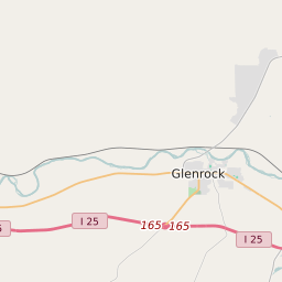
Map of Converse County Precinct Level Results for the 2020 Presidential Election
D 80-100% |
D 70-80% |
D 60-70% |
D 45-60% |
R 45-60% |
R 60-70% |
R 70-80% |
R 80-100% |
List of Converse County Precinct Level Results for the 2020 Presidential Election | ||||||||
|---|---|---|---|---|---|---|---|---|
| Map Index | Precinct | City/Town | ZIP Code | Joe Biden Democrat | Donald Trump Republican | Jo Jorgensen Libertarian | ||
| BOX ELDER | 82636 | 18 (5.59%) | 299 (92.86%) | 5 (1.55%) | ||||
| COURTHOUSE | Douglas | 82633 | 136 (19.32%) | 555 (78.84%) | 13 (1.85%) | |||
| DRY CREEK | 82229 | 7 (6.42%) | 102 (93.58%) | 0 (0%) | ||||
| EAST ANTELOPE | Orin | 82229 | 22 (6.96%) | 287 (90.82%) | 7 (2.22%) | |||
| FAIRVIEW | Douglas | 82633 | 50 (14.97%) | 277 (82.93%) | 7 (2.1%) | |||
| GLENROCK | 82633 | 48 (13.45%) | 305 (85.43%) | 4 (1.12%) | ||||
| GLENROCK EAST | Glenrock | 82637 | 90 (14.11%) | 531 (83.23%) | 17 (2.66%) | |||
| GLENROCK WEST | Glenrock | 82637 | 90 (18.15%) | 395 (79.64%) | 11 (2.22%) | |||
| GUTHRIE | Esterbrook | 82637 | 18 (9.68%) | 163 (87.63%) | 5 (2.69%) | |||
| LA PRELE | 82637 | 23 (10.65%) | 188 (87.04%) | 5 (2.31%) | ||||
| LOST SPRINGS | Douglas | 82224 | 11 (5.82%) | 177 (93.65%) | 1 (0.53%) | |||
| NORTHEAST DOUGLAS | Douglas | 82633 | 54 (16.36%) | 267 (80.91%) | 9 (2.73%) | |||
| NORTHWEST DOUGLAS | Douglas | 82633 | 56 (10.22%) | 487 (88.87%) | 5 (0.91%) | |||
| ORIN | Douglas | 82633 | 46 (10.72%) | 380 (88.58%) | 3 (0.7%) | |||
| ORPHA | 82637 | 7 (6.36%) | 101 (91.82%) | 2 (1.82%) | ||||
| ROLLING HILLS | Rolling Hills | 82637 | 19 (8.48%) | 201 (89.73%) | 4 (1.79%) | |||
| RURAL DOUGLAS | Douglas | 82633 | 43 (8.48%) | 459 (90.53%) | 5 (0.99%) | |||
| SOUTH DOUGLAS | Douglas | 82633 | 54 (15.61%) | 285 (82.37%) | 7 (2.02%) | |||
| SOUTHWEST DOUGLAS | Douglas | 82633 | 69 (12.83%) | 458 (85.13%) | 11 (2.04%) | |||


