Hazard Independent School District Data and Boundary Map
Hazard Independent School District Data
| District Name | Hazard Independent School District |
| State | Kentucky |
| County | Perry County |
| Cities/Towns | |
| Total Students (2021) | 955 |
| District Growth Rate (2017-21) | -4.5% |
| Majority Race/Ethnicty | White (88.1%) |
| Free/Reduced Lunch Program | 62.3% |
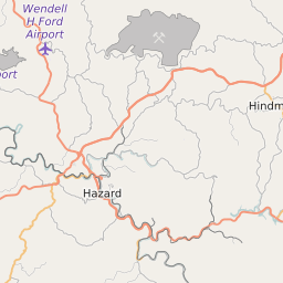
Hazard Independent School District Boundary Map


Hazard Independent School District Attendance Area Maps
Hazard Independent School District Related Maps
- Hazard Independent School District Elementary School Free/Reduced Lunch Program Map
- Hazard Independent School District Elementary School Race/Ethnicity Map
- Hazard Independent School District Elementary School Title I Status Map
- Hazard Independent School District Middle School Free/Reduced Lunch Program Map
- Hazard Independent School District Middle School Race/Ethnicity Map
- Hazard Independent School District Middle School Title I Status Map
- Hazard Independent School District High School Free/Reduced Lunch Program Map
- Hazard Independent School District High School Race/Ethnicity Map
- Hazard Independent School District High School Title I Status Map