ZipDataMaps
Blog
About
Data and Maps
US ZIP Codes
ZIP Code Tools
Canada Postal Codes
Area Codes
Politics
POI Data
Regional Market Areas
Neighborhoods
Economics
Counties
Places
Schools
Home
Schools
Minneapolis Public School District
Minneapolis Public School District Elementary School Free and Reduced Lunch Program Participation
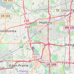
Map of Minneapolis Public School District Elementary School Free and Reduced Lunch Program Participation
Related
List
< 20%
20 - 40%
40 - 60%
60 - 80%
> 80%
No Data
Click on the map for more information about each school boundary. Add City/Town and County Boundaries to the map using the icon in the upper right corner of the map.
Share:
Change Map:
Map of Minneapolis Public School District Middle School Free/Reduced Lunch Program Participation
Map of Minneapolis Public School District High School Free/Reduced Lunch Program Participation
List of Elementary Schools in Minneapolis Public School District Minnesota
Map Key
School Name
ZIP Code
City
Free/Reduced Lunch Program Participation
Andersen Community
55407
Minneapolis
90.90%
Armatage Elementary School
55410
Minneapolis
21.25%
Bancroft Elementary School
55407
Minneapolis
60.53%
Barton Elementary School
55409
Minneapolis
41.83%
Bryn Mawr Elementary School
55405
Minneapolis
71.48%
Burroughs Elementary School
55419
Minneapolis
11.94%
Cityview Community School
55412
Minneapolis
78.01%
Dowling Elementary School
55406
Minneapolis
36.58%
Folwell Elementary School
55407
Minneapolis
86.73%
Hale Elementary School
55417
Minneapolis
11.13%
Hiawatha Elementary School
55406
Minneapolis
23.64%
Hmong International Academy
55411
Minneapolis
81.80%
Jenny Lind Elementary School
55430
Minneapolis
84.36%
Kenny Elementary School
55419
Minneapolis
16.99%
Kenwood Elementary School
55405
Minneapolis
23.16%
Lake Harriet Lower Elementary School
55410
Minneapolis
5.27%
Loring Elementary School
55412
Minneapolis
58.35%
Lucy Laney Elementary School
55412
Minneapolis
87.15%
Lyndale Elementary School
55408
Minneapolis
42.04%
Nellie Stone Johnson Elementary School
55411
Minneapolis
92.93%
Northrop Elementary School
55406
Minneapolis
20.36%
Pillsbury Elementary School
55418
Minneapolis
70.24%
Pratt Elementary School
55414
Minneapolis
63.70%
Waite Park Elementary School
55418
Minneapolis
32.68%
Webster Elementary School
55413
Minneapolis
50.16%
Wenonah Elementary School
55417
Minneapolis
35.08%
Whittier International Elementary School
55404
Minneapolis
71.81%
Windom Elementary School
55419
Minneapolis
31.63%
Related Maps:
Map of Minneapolis Public School District Elementary School Attendance Zones
Map of Minneapolis Public School District Middle School Attendance Zones
Map of Minneapolis Public School District High School Attendance Zones
Map of Minneapolis Public School District Elementary Schools Race/Ethnicity
Map of Minneapolis Public School District Middle Schools Race/Ethnicity
Map of Minneapolis Public School District High Schools Race/Ethnicity
Map of Minneapolis Public School District Elementary Schools Title 1 Status
Map of Minneapolis Public School District Middle Schools Title 1 Status
Map of Minneapolis Public School District High Schools Title 1 Status
Most Popular ZIP Code Searches in Minnesota
55044
55901
55106
55124
55303
56001
55304
55379
55337
55112
55125
55117
55119
55104
55330
56560
55113
55016
55110
55369
55311
55407
55423
55024
55082
55406
56301
55416
56601
55109
55372
55433
55987
55414
55428
55443
55434
55432
55449
55408
About
Contact
Terms
Privacy
ZIP Code Blog
Twitter
Facebook
E-mail
2024 zipdatamaps.com