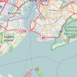
ZIP Code 11411 - Cambria Heights Map and Data

Map of ZIP Code 11411 Border

Official Zip Code NameCambria Heights
Zip Code StateNew York
Zip Code TypeNon-Unique
Primary County: Queens
Area Code347 / 718 / 917 / 929
Alternate Zip Code NamesCAMBRIA HTS
JAMAICA
Unacceptable Zip Code NamesQUEENS
Current Population:18556
Racial Majority:African American 90.7%
Public School Racial Majority:Black 84.8%
Unemployment Rate:5.3%
Median Household Income$80416
Average Adjusted Gross Income$55590
School Test Performance:Below Average
Average Commute Time48.5 Minutes
Time Zone:Eastern Daylight Time
Elevation Range62 - 62 ft.
Area1 Sqm.
Coordinates(Y,X)40.69418000, -73.73581300

Zip Code 11411 Profile

ZIP Code 11411 is located in the state of New York in the Metro New York City metro area. ZIP code 11411 is primarily located in Queens County. The official US Postal Service name for 11411 is CAMBRIA HEIGHTS, New York. Portions of ZIP code 11411 are contained within or border the city limits of New York, NY, Elmont, NY, and North Valley Stream, NY. ZIP code 11411 is within area code 917, area code 347 and area code 718. 11411 can be classified socioeconically as a Middle Class class zipcode in comparison to other zipcodes in New York.

The current unemployment level in 11411 is 5.3% which is higher than the current county unemployment level of 5.0% and is higher than the current state unemployment at 3.8% and higher than the current national unemployment rate at 3.7%.

According the 2010 US Census, the population of 11411 decreased to 18556 from 21282 over the past 10 years. The majority ethnicity residing in 11411 is African American while the majority ethnicity attending 11411 public schools is Black. 71.1% of students in 11411 public schools receive or are eligible to participate in free or reduced lunch programs.

20142010Change(+/-)
 White 315 1.64% 247 +28%
 Black Or African American 17394 90.7% 16766 +4%
 Hispanic 821 4.28% 991 -17%
 American Indian Or Alaskan Native 80 0.42% 46 +74%
 Asian 246 1.28% 126 +95%
 Native Hawaiian & Other Pacific Islander 0 0% 5 -100%
 Other Race 65 0.04% 65 -88%
 Two Or More Races 310 1.63% 310 +1%

Zip Code 11411 Race/Ethnicity

 White 1.3%
 Black Or African American 84.8%
 Hispanic 8.4%
 Asian 4.4%
 Hawaii/Pacific Islander 0%
 American Indian Or Alaskan Native 0.8%
 Two or More Races 0.3%

Zip Code 11411 Public School Race/Ethnicity Profile

20102000
Total Population1855621282
Male Population44.80%
Female Population55.20%
Total Households5893
Test Score PerformanceBelow Average
Percentage of Students Eligible For
Free or Reduced Lunch
71.1%
Percentage of Public Schools with
Title 1 Status
100.0%
Median Household Income$80416
Income Under $50K Per Year26.30%
Income $50K to $100K Per Year36.60%
Income Above $100K Per Year37.00%
11411 US Congressional District
DistrictRepresentativeParty Affiliation
New York District 5Gregory MeeksDemocrat
Related Maps: Map of All New York Congressional Districts

Average Real Estate Asking Price$358265
Average Real Estate Sale Price$333086
Current Unemployment Level 5.3%
Previous Month Unemployment Level5.2%
Unemployment Level 1 Year Ago7.3%
2012 Hardiness ZoneZone 7b: 5F to 10F
1990 Hardiness ZoneZone 7a: 0F to 5F
Köppen Climate ClassificationCfa - Humid Subtropical Climate
Ecoregion 59g - Long Island Sound Coastal Lowland
Average First Frost DatesNovember 11 - 20
Average Last Frost DatesApril 1 - 10

Zip Code 11411 Annual Climate Data

JanFebMarAprMayJunJulAugSepOctNovDecAnnual
Avg Min Temp (°F)25263342526167665948393046
Avg Max Temp (°F)38414959707884827564534361
Avg Precip (In.)3.782.894.054.014.213.664.043.813.773.313.723.5344.8
Core Based Statistical
Area (CBSA)
New York-Northern New Jersey-Long Island, NY-NJ-PA
CBSA Type11411
CBSA Population19113505
Time ZoneEastern Daylight Time
IANA Time ZoneAmerica/New_York
Follows DSTYes
GMT Difference-5 Hours