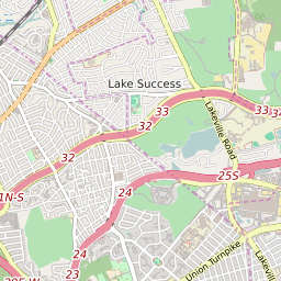
ZIP Code 11427 - Queens Village Map and Data

Map of ZIP Code 11427 Border

Official Zip Code NameQueens Village
Zip Code StateNew York
Zip Code TypeNon-Unique
Primary County: Queens
Area Code347 / 718 / 917 / 929
Alternate Zip Code NamesBELLEROSE MANOR
BELLRS MANOR
JAMAICA
QUEENS VLG
Unacceptable Zip Code NamesHOLLIS HILLS
QUEENS
Current Population:23593
Racial Majority:White 20.15%
Public School Racial Majority:Black 41.9%
Unemployment Rate:5.3%
Median Household Income$66639
Average Adjusted Gross Income$63380
School Test Performance:Above Average
Average Commute Time41.8 Minutes
Time Zone:Eastern Daylight Time
Elevation Range0-0 Feet
Area1 Sqm.
Coordinates(Y,X)40.72956300, -73.74997200

Zip Code 11427 Profile

ZIP Code 11427 is located in the state of New York in the Metro New York City metro area. ZIP code 11427 is primarily located in Queens County. The official US Postal Service name for 11427 is QUEENS VILLAGE, New York. Portions of ZIP code 11427 are contained within or border the city limits of New York, NY, . ZIP code 11427 is within area code 347, area code 917 and area code 718. 11427 can be classified socioeconically as a Middle Class class zipcode in comparison to other zipcodes in New York.

The current unemployment level in 11427 is 5.3% which is higher than the current county unemployment level of 5.0% and is higher than the current state unemployment at 3.8% and higher than the current national unemployment rate at 3.7%.

According the 2010 US Census, the population of 11427 increased to 23593 from 23014 over the past 10 years. The majority ethnicity residing in 11427 is White while the majority ethnicity attending 11427 public schools is Black. 71.1% of students in 11427 public schools receive or are eligible to participate in free or reduced lunch programs.

20142010Change(+/-)
 White 4728 20.15% 4605 +3%
 Black Or African American 5702 24.31% 5374 +6%
 Hispanic 3398 14.48% 3996 -15%
 American Indian Or Alaskan Native 0 0% 100 -100%
 Asian 7623 32.49% 7567 +1%
 Native Hawaiian & Other Pacific Islander 0 0% 48 -100%
 Other Race 954 4.22% 954 +4%
 Two Or More Races 949 4.34% 949 +7%

Zip Code 11427 Race/Ethnicity

 White 3.5%
 Black Or African American 41.9%
 Hispanic 14.4%
 Asian 37.2%
 Hawaii/Pacific Islander 0%
 American Indian Or Alaskan Native 2.5%
 Two or More Races 0.5%

Zip Code 11427 Public School Race/Ethnicity Profile

20102000
Total Population2359323014
Male Population48.40%
Female Population51.60%
Total Households7683
Test Score PerformanceAbove Average
Percentage of Students Eligible For
Free or Reduced Lunch
71.1%
Percentage of Public Schools with
Title 1 Status
100.0%
Median Household Income$66639
Income Under $50K Per Year35.00%
Income $50K to $100K Per Year35.70%
Income Above $100K Per Year29.20%
11427 US Congressional District
DistrictRepresentativeParty Affiliation
New York District 3Thomas SuozziDemocrat
New York District 5Gregory MeeksDemocrat
Related Maps: Map of All New York Congressional Districts

Average Real Estate Asking Price$444690
Average Real Estate Sale Price$498436
Current Unemployment Level 5.3%
Previous Month Unemployment Level5.2%
Unemployment Level 1 Year Ago7.3%
2012 Hardiness ZoneZone 7b: 5F to 10F
1990 Hardiness ZoneZone 7a: 0F to 5F
Köppen Climate ClassificationCfa - Humid Subtropical Climate
Ecoregion 59g - Long Island Sound Coastal Lowland
Average First Frost DatesNovember 11 - 20
Average Last Frost DatesApril 1 - 10

Zip Code 11427 Annual Climate Data

JanFebMarAprMayJunJulAugSepOctNovDecAnnual
Avg Min Temp (°F)25263342526167665948393046
Avg Max Temp (°F)38414959707984827564534361
Avg Precip (In.)3.822.944.134.074.263.674.093.93.93.443.843.6345.71
Core Based Statistical
Area (CBSA)
New York-Northern New Jersey-Long Island, NY-NJ-PA
CBSA Type11427
CBSA Population19113505
Time ZoneEastern Daylight Time
IANA Time ZoneAmerica/New_York
Follows DSTYes
GMT Difference-5 Hours