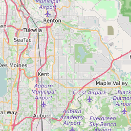
ZIP Code 98058 - Renton Map and Data

Map of ZIP Code 98058 Border

Official Zip Code NameRenton
Zip Code StateWashington
Zip Code TypeNon-Unique
Primary County: King
Area Code425
Current Population:41938
Racial Majority: 58.09%
Public School Racial Majority:White 34.6%
Unemployment Rate:2.9%
Median Household Income$81991
Average Adjusted Gross Income$82940
School Test Performance:Average
Average Commute Time31.8 Minutes
Time Zone:Pacific Daylight Time
Elevation Range364 - 564 ft.
Area22 Sqm.
Coordinates(Y,X)47.43910400, -122.12300700

Zip Code 98058 Profile

ZIP Code 98058 is located in the state of Washington in the Seattle - Tacoma metro area. ZIP code 98058 is primarily located in King County. The official US Postal Service name for 98058 is RENTON, Washington. Portions of ZIP code 98058 are contained within or border the city limits of Cascade-Fairwood, WA, Maple Heights-Lake Desire, WA, East Hill-Meridian, WA, Renton, WA, East Renton Highlands, WA, and Hobart, WA. ZIP code 98058 is within area code 425 and area code 253. 98058 can be classified socioeconically as a Middle Class class zipcode in comparison to other zipcodes in Washington.

The current unemployment level in 98058 is 2.9% which is lower than the current county unemployment level of 3.9% and is lower than the current state unemployment at 4.4% and lower than the current national unemployment rate at 3.7%.

According the 2010 US Census, the population of 98058 increased to 41938 from 37481 over the past 10 years. The majority ethnicity residing in 98058 is while the majority ethnicity attending 98058 public schools is White. 49.2% of students in 98058 public schools receive or are eligible to participate in free or reduced lunch programs.

20142010Change(+/-)
 White 24841 58.09% 25874 -4%
 Black Or African American 3615 8.45% 3227 +12%
 Hispanic 3878 9.07% 3543 +9%
 American Indian Or Alaskan Native 86 0.2% 180 -52%
 Asian 7604 17.78% 6679 +14%
 Native Hawaiian & Other Pacific Islander 148 0.35% 245 -40%
 Other Race 78 0.14% 78 -26%
 Two Or More Races 2112 5.93% 2112 +20%

Zip Code 98058 Race/Ethnicity

 White 34.6%
 Black Or African American 14.3%
 Hispanic 18.5%
 Asian 21.3%
 Hawaii/Pacific Islander 1.1%
 American Indian Or Alaskan Native 0.6%
 Two or More Races 9.6%

Zip Code 98058 Public School Race/Ethnicity Profile

20102000
Total Population4193837481
Male Population49.60%
Female Population50.40%
Total Households15395
Test Score PerformanceAverage
Percentage of Students Eligible For
Free or Reduced Lunch
49.2%
Percentage of Public Schools with
Title 1 Status
72.7%
Median Household Income$81991
Income Under $50K Per Year24.40%
Income $50K to $100K Per Year38.00%
Income Above $100K Per Year37.60%
98058 US Congressional District
DistrictRepresentativeParty Affiliation
Washington District 8Kim SchrierDemocrat
Washington District 9Adam SmithDemocrat
Related Maps: Map of All Washington Congressional Districts

Average Real Estate Asking Price$279853
Average Real Estate Sale Price$270202
Current Unemployment Level 2.9%
Previous Month Unemployment Level3.1%
Unemployment Level 1 Year Ago4.2%
2012 Hardiness ZoneZone 8b: 15F to 20F
1990 Hardiness ZoneZone 8a: 10F to 15F
Köppen Climate ClassificationCfb - Oceanic Climate
Ecoregion 2e - Eastern Puget Uplands
Average First Frost DatesOctober 21 - 31
Average Last Frost DatesApril 11 - 20

Zip Code 98058 Annual Climate Data

JanFebMarAprMayJunJulAugSepOctNovDecAnnual
Avg Min Temp (°F)34363841465154545043383443
Avg Max Temp (°F)46505460667176777161514561
Avg Precip (In.)5.694.644.1732.211.83.941.21.93.626.466.2341.9
Core Based Statistical
Area (CBSA)
Seattle-Tacoma-Bellevue, WA
CBSA Type98058
CBSA Population3461985
Time ZonePacific Daylight Time
IANA Time ZoneAmerica/Los_Angeles
Follows DSTYes
GMT Difference-8 Hours