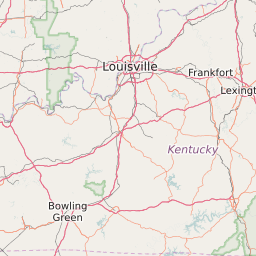
ZipDataMaps
Blog
About
Data and Maps
US ZIP Codes
ZIP Code Tools
Canada Postal Codes
Area Codes
Politics
POI Data
Regional Market Areas
Neighborhoods
Economics
Counties
Places
Schools
Home
Kentucky Atlas
Kentucky
Kentucky County Map
Map and List of All Counties in Kentucky
Map of All Counties in Kentucky
Share:
List of All Counties in Kentucky
Map Key
Name
Population
Adair County
18,651
Allen County
20,007
Anderson County
21,442
Ballard County
8,268
Barren County
42,229
Bath County
11,665
Bell County
28,613
Boone County
119,406
Bourbon County
20,004
Boyd County
49,358
Boyle County
28,445
Bracken County
8,488
Breathitt County
13,922
Breckinridge County
20,068
Bullitt County
74,431
Butler County
12,748
Caldwell County
12,977
Calloway County
37,198
Campbell County
90,119
Carlisle County
5,081
Carroll County
10,851
Carter County
27,594
Casey County
15,984
Christian County
73,722
Clark County
35,555
Clay County
21,833
Clinton County
10,244
Crittenden County
9,321
Cumberland County
6,857
Daviess County
96,711
Edmonson County
12,141
Elliott County
7,774
Estill County
14,647
Fayette County
296,766
Fleming County
14,415
Floyd County
39,454
Franklin County
49,399
Fulton County
6,758
Gallatin County
8,513
Garrard County
16,892
Grant County
24,683
Graves County
37,200
Grayson County
25,772
Green County
11,309
Greenup County
36,922
Hancock County
8,588
Hardin County
104,513
Harlan County
29,210
Harrison County
18,781
Hart County
18,278
Henderson County
46,254
Henry County
15,428
Hickman County
4,869
Hopkins County
46,891
Jackson County
13,475
Jefferson County
741,285
Jessamine County
48,591
Johnson County
23,339
Kenton County
159,926
Knott County
16,368
Knox County
31,874
Larue County
14,175
Laurel County
58,891
Lawrence County
15,889
Lee County
7,831
Leslie County
11,318
Letcher County
24,336
Lewis County
13,889
Lincoln County
24,671
Livingston County
9,479
Logan County
26,786
Lyon County
8,336
Madison County
83,174
Magoffin County
13,229
Marion County
19,872
Marshall County
31,393
Martin County
12,934
Mason County
17,495
Mccracken County
65,558
Mccreary County
18,204
Mclean County
9,554
Meade County
28,979
Menifee County
6,331
Mercer County
21,283
Metcalfe County
10,074
Monroe County
10,925
Montgomery County
26,517
Morgan County
13,898
Muhlenberg County
31,399
Nelson County
43,500
Nicholas County
7,092
Ohio County
23,975
Oldham County
60,357
Owen County
10,870
Owsley County
4,764
Pendleton County
14,771
Perry County
28,617
Pike County
64,887
Powell County
12,638
Pulaski County
63,045
Robertson County
2,251
Rockcastle County
17,090
Rowan County
23,351
Russell County
17,562
Scott County
47,211
Shelby County
42,286
Simpson County
17,323
Spencer County
17,135
Taylor County
24,514
Todd County
12,472
Trigg County
14,282
Trimble County
8,829
Union County
14,992
Warren County
113,787
Washington County
11,701
Wayne County
20,819
Webster County
13,618
Whitley County
35,756
Wolfe County
7,298
Woodford County
24,847
About
Contact
Terms
Privacy
ZIP Code Blog
Twitter
Facebook
E-mail
2024 zipdatamaps.com