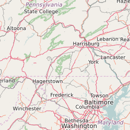
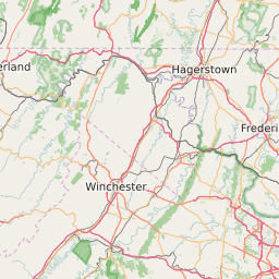
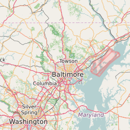
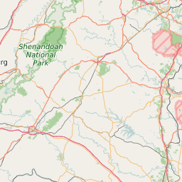
Partisan Voting Index for Counties in Maryland
This Map Displays the Partisan Voting Index Value for each county in Maryland. The Partisan Voting Index (PVI) is a measurement of how strongly a county leans toward the Democratic or Republican Party. The PVI is calculated by taking the average percentage for the winning party in a county for the last two elections and subtracting that value from the national average for that party in the same two elections. The data is based on results from the 2024 and 2020 presidential election. Of the 24 Counties in Maryland The County with the highest Republican PVI is Garrett County at +28. The County with the highest Democrat PVI is Prince Georges County at +38.
Map of Partisan Voting Index (PVI) for Counties in Maryland
Rep +20 | Rep. 15-19 | Rep. 10-14 | Rep. 5-9 | Rep. 1-4 | Even | Dem 1-4 | Dem 5-9 | Dem 10-14 | Dem 15-19 | Dem +20 |


List of All Counties in Maryland With Partisan Voting Index (2024 Presidential Election Results) | ||||
|---|---|---|---|---|
| Map Key | Name | Partisan Voting Index (2024) | ||
| Allegany County | Republican +20 | |||
| Anne Arundel County | Democrat +6 | |||
| Baltimore City County | Democrat +36 | |||
| Baltimore County | Democrat +12 | |||
| Calvert County | Republican +5 | |||
| Caroline County | Republican +18 | |||
| Carroll County | Republican +12 | |||
| Cecil County | Republican +15 | |||
| Charles County | Democrat +20 | |||
| Dorchester County | Republican +7 | |||
| Frederick County | Democrat +3 | |||
| Garrett County | Republican +28 | |||
| Harford County | Republican +7 | |||
| Howard County | Democrat +20 | |||
| Kent County | Republican +1 | |||
| Montgomery County | Democrat +27 | |||
| Prince Georges County | Democrat +38 | |||
| Queen Annes County | Republican +14 | |||
| Saint Marys County | Republican +8 | |||
| Somerset County | Republican +9 | |||
| Talbot County | Republican +1 | |||
| Washington County | Republican +12 | |||
| Wicomico County | Republican +2 | |||
| Worcester County | Republican +11 | |||