


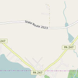
Vandling Pennsylvania Profile
| Place Name | Vandling |
| Place Type | Borough |
| ZIP Code(s) | 18407 18421 18472 |
| County | Lackawanna County |
| Area Code(s) | 272,570 |
| Timezone | Eastern Daylight Time (EDT) |
| Population (2022) | 605 |
| Population Growth Rate (2010-19) | -2.80% |
| Majority Ethnicity | White 97.79% |
| Metro/Micro Stats Area | Scranton--Wilkes-Barre, PA |
| US Congressional District(s) | Pennsylvania 10th |
| State House Districts | 114 |
| State Senate Districts | 22 |
Vandling Race/Ethnicity Data
| Race/Ethnicy | Percentage of Population (2021) |
|---|---|
| White | 97.79% |
| African American | 0% |
| Hispanic | 0% |
| Asian | 0% |
| Native American | 0% |
| Hawaiin/Pacific Islander | 2.21% |