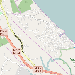


Long Beach Maryland Profile
| Place Name | Long Beach |
| Place Type | Census Designated Place |
| ZIP Code(s) | 20657 20685 |
| County | Calvert County |
| Area Code(s) | 410,443,667 |
| Timezone | Eastern Daylight Time (EDT) |
| Population (2022) | 1,880 |
| Population Growth Rate (2010-19) | -4.50% |
| Majority Ethnicity | White 90.7% |
| Metro/Micro Stats Area | Washington-Arlington-Alexandria, DC-VA-MD-WV |
| US Congressional District(s) | Maryland 5th |
| House of Delegates Districts | 27C |
| State Senate Districts | 27 |
Long Beach Race/Ethnicity Data
| Race/Ethnicy | Percentage of Population (2021) |
|---|---|
| White | 90.7% |
| African American | 1.5% |
| Hispanic | 0% |
| Asian | 0% |
| Native American | 0% |
| Hawaiin/Pacific Islander | 7.8% |