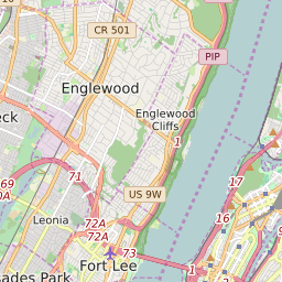


Englewood New Jersey Profile
| Place Name | Englewood |
| Place Type | City |
| ZIP Code(s) | 07631 |
| County | Bergen County |
| Area Code(s) | 201,551 |
| Timezone | Eastern Standard Time (EST) |
| Population (2022) | 27,205 |
| Population Growth Rate (2010-19) | 7.96% |
| Majority Ethnicity | White 43.21% |
| Metro/Micro Stats Area | New York-Newark-Jersey City, NY-NJ-PA |
| US Congressional District(s) | New Jersey 9th |
| State Assembly Districts | 37 |
| State Senate Districts | 37 |
Englewood Race/Ethnicity Data
| Race/Ethnicy | Percentage of Population (2021) |
|---|---|
| White | 43.21% |
| African American | 23.23% |
| Hispanic | 0.33% |
| Asian | 9.95% |
| Native American | 0% |
| Hawaiin/Pacific Islander | 23.28% |