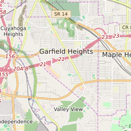
Garfield Heights Ohio Profile
| Place Name | Garfield Heights |
| Place Type | City |
| ZIP Code(s) | 44105 44125 44128 44137 |
| County | Cuyahoga County |
| Area Code(s) | 216 |
| Timezone | Eastern Standard Time (EST) |
| Population (2022) | 28,755 |
| Population Growth Rate (2010-19) | 3.23% |
| Majority Ethnicity | African American 57.67% |
| Metro/Micro Stats Area | Cleveland-Elyria, OH |
| US Congressional District(s) | Ohio 11th |
| State House Districts | 11 |
| State Senate Districts | 21 |
Garfield Heights Race/Ethnicity Data
| Race/Ethnicy | Percentage of Population (2021) |
|---|---|
| White | 36.5% |
| African American | 57.67% |
| Hispanic | 0.04% |
| Asian | 0.22% |
| Native American | 0.02% |
| Hawaiin/Pacific Islander | 5.56% |