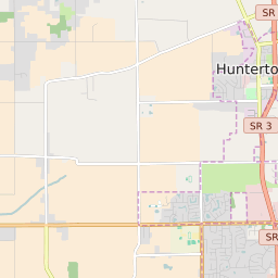


Huntertown Indiana Profile
| Place Name | Huntertown |
| Place Type | Town |
| ZIP Code(s) | 46748 |
| County | Allen County |
| Area Code(s) | 260 |
| Timezone | Eastern Standard Time (EST) |
| Population (2022) | 4,843 |
| Population Growth Rate (2010-19) | 90.04% |
| Majority Ethnicity | White 88.44% |
| Metro/Micro Stats Area | Fort Wayne, IN |
| US Congressional District(s) | Indiana 3rd |
| State House Districts | 52 |
| State Senate Districts | 15 |
Huntertown Race/Ethnicity Data
| Race/Ethnicy | Percentage of Population (2021) |
|---|---|
| White | 88.44% |
| African American | 3.41% |
| Hispanic | 0.16% |
| Asian | 4.84% |
| Native American | 0.14% |
| Hawaiin/Pacific Islander | 3.02% |