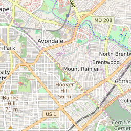
Brentwood Maryland Profile
| Place Name | Brentwood |
| Place Type | Town |
| ZIP Code(s) | 20722 |
| County | Prince Georges County |
| Area Code(s) | 240,301 |
| Timezone | Eastern Daylight Time (EDT) |
| Population (2022) | 3,053 |
| Population Growth Rate (2010-19) | 25.67% |
| Majority Ethnicity | Hispanic 0.4% |
| Metro/Micro Stats Area | Washington-Arlington-Alexandria, DC-VA-MD-WV |
| US Congressional District(s) | Maryland 4th |
| House of Delegates Districts | 47A |
| State Senate Districts | 47 |
Brentwood Race/Ethnicity Data
| Race/Ethnicy | Percentage of Population (2021) |
|---|---|
| White | 14.3% |
| African American | 31.8% |
| Hispanic | 0.4% |
| Asian | 1.57% |
| Native American | 0% |
| Hawaiin/Pacific Islander | 51.92% |