
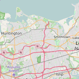


Huntington (town) New York Profile
| Place Name | Huntington (town) |
| Place Type | Town |
| County | Suffolk County |
| Area Code(s) | 631,934 |
| Timezone | Eastern Standard Time (EST) |
| Population (2021) | 204,147 |
| Majority Ethnicity | White 79.19% |
| Metro/Micro Stats Area | New York-Newark-Jersey City, NY-NJ-PA |
| US Congressional District(s) | New York 3rd |
| State Assembly Districts | 10,12 |
| State Senate Districts | 2,5 |
Huntington (town) Race/Ethnicity Data
| Race/Ethnicy | Percentage of Population (2021) |
|---|---|
| White | 79.19% |
| African American | 3.88% |
| Hispanic | 0.37% |
| Asian | 5.27% |
| Native American | 0% |
| Hawaiin/Pacific Islander | 11.29% |