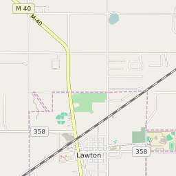


Lawton Michigan Profile
| Place Name | Lawton |
| Place Type | Village |
| ZIP Code(s) | 49065 |
| County | Van Buren County |
| Area Code(s) | 269 |
| Timezone | Eastern Daylight Time (EDT) |
| Population (2022) | 1,883 |
| Population Growth Rate (2010-19) | -2.63% |
| Majority Ethnicity | White 88.24% |
| US Congressional District(s) | Michigan 6th |
| State House Districts | 66 |
| State Senate Districts | 26 |
Lawton Race/Ethnicity Data
| Race/Ethnicy | Percentage of Population (2021) |
|---|---|
| White | 88.24% |
| African American | 1.69% |
| Hispanic | 1.42% |
| Asian | 1.58% |
| Native American | 0% |
| Hawaiin/Pacific Islander | 7.08% |