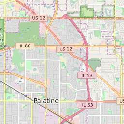
60067 can be classified socioeconomically as Middle Class class compared to other ZIP Codes in Illinois based on Median Household Income and Average Adjusted Gross Income. The majority race/ethnicity residing in 60067 is White. The majority race/ethnicity attending public schools in 60067 is White. The current unemployment level in 60067 is 4.5%.
| Population | 38,380 |
| Population Growth Rate | 0.00% |
| Population Density | 2,851 People per Square Mile |
| Total Households | 15,003 |
| Percentage High Income Households | 14.9% |
| Median Household Income (2021) | $117,823 |
| Average Adjusted Gross Income (2021) | $604,880 |
| Current Unemployment Rate (June 2025) | 4.5% |
| Majority Race/Ethnicty | White - 72.81% |
| Public School Majority Race/Ethnicty | White - 49.83% |
60067 Race/Ethnicty Breakdown
| Race/Ethnicty | Total | Percentage |
|---|
| White | 28,198 | 72.81% |
| Black | 1,039 | 2.68% |
| Hispanic | 3,053 | 7.88% |
| Asian | 6,412 | 16.56% |
| Native American | 25 | 0.06% |
| Hawaiian/Pac. Islander | 2 | 0.01% |
60067 Public School Race/Ethnicty Breakdown
| Race/Ethnicty | Total | Percentage |
|---|
| White | 3,425 | 51.69% |
| Black | 261 | 3.94% |
| Hispanic | 1,156 | 17.45% |
| Asian | 1,754 | 26.47% |
| Native American | 19 | 0.29% |
| Hawaiian/Pac. Islander | 11 | 0.17% |
60067 Educational Attainment Levels
| Highest Education Level Attained | Total | Percentage |
|---|
| Less Than 1 Year of College | 1,128 | 4.4% |
| Bachelor Degree | 9,026 | 35.18% |
| High School Diploma | 4,092 | 15.95% |
| No High School Diploma | 255 | 0.99% |
| GED or Alternate | 479 | 1.87% |
| 1 or More Years of College | 2,878 | 11.22% |
| Associates Degree | 1,555 | 6.06% |
| Masters Degree | 4,750 | 18.51% |
| Professional Degree | 1,017 | 3.96% |
| Doctorate Degree | 478 | 1.86% |