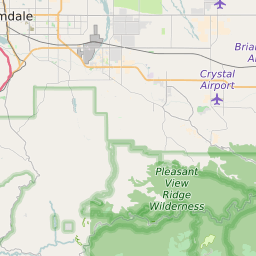
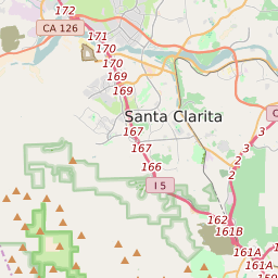
ZIP Code 91311 - Chatsworth Map and Data

Map of ZIP Code 91311 Border

Official Zip Code NameChatsworth
Zip Code StateCalifornia
Zip Code TypeNon-Unique
Primary County: Los Angeles
Secondary County: Ventura
Area Code747 / 818
Current Population:36557
Racial Majority:White 51.11%
Public School Racial Majority:Hispanic 50.4%
Unemployment Rate:4.5%
Median Household Income$78398
Average Adjusted Gross Income$95420
School Test Performance:Average
Average Commute Time30.6 Minutes
Time Zone:Pacific Daylight Time
Elevation Range915 - 2746 ft.
Area31 Sqm.
Coordinates(Y,X)34.28568100, -118.60454900

Zip Code 91311 Profile

ZIP Code 91311 is located in the state of California in the Reno metro area. ZIP code 91311 is primarily located in Los Angeles County. Portions of 91311 are also located in Ventura County. The official US Postal Service name for 91311 is CHATSWORTH, California. Portions of ZIP code 91311 are contained within or border the city limits of Los Angeles, CA, Simi Valley, CA, . ZIP code 91311 is within area code 747, area code 818 and area code 805. 91311 can be classified socioeconically as a Middle Class class zipcode in comparison to other zipcodes in California.

The current unemployment level in 91311 is 4.5% which is lower than the current county unemployment level of 5.3% and is higher than the current state unemployment at 3.7% and higher than the current national unemployment rate at 3.7%.

According the 2010 US Census, the population of 91311 increased to 36557 from 35317 over the past 10 years. The majority ethnicity residing in 91311 is White while the majority ethnicity attending 91311 public schools is Hispanic. 56.5% of students in 91311 public schools receive or are eligible to participate in free or reduced lunch programs.

20142010Change(+/-)
 White 19302 51.11% 19873 -3%
 Black Or African American 1174 3.11% 1475 -20%
 Hispanic 8852 23.44% 7934 +12%
 American Indian Or Alaskan Native 12 0.03% 95 -87%
 Asian 7122 18.86% 5959 +20%
 Native Hawaiian & Other Pacific Islander 22 0.06% 52 -58%
 Other Race 91 0.18% 91 -26%
 Two Or More Races 1078 3.22% 1078 +13%

Zip Code 91311 Race/Ethnicity

 White 23.5%
 Black Or African American 7.1%
 Hispanic 50.4%
 Asian 18%
 Hawaii/Pacific Islander 0.4%
 American Indian Or Alaskan Native 0.6%
 Two or More Races 0%

Zip Code 91311 Public School Race/Ethnicity Profile

20102000
Total Population3655735317
Male Population48.80%
Female Population51.20%
Total Households13425
Test Score PerformanceAverage
Percentage of Students Eligible For
Free or Reduced Lunch
56.5%
Percentage of Public Schools with
Title 1 Status
50.0%
Median Household Income$78398
Income Under $50K Per Year26.10%
Income $50K to $100K Per Year38.20%
Income Above $100K Per Year35.70%
91311 US Congressional District
DistrictRepresentativeParty Affiliation
California District 25Katie HillDemocrat
California District 30Brad ShermanDemocrat
Related Maps: Map of All California Congressional Districts

Average Real Estate Asking Price$560837
Average Real Estate Sale Price$471952
Current Unemployment Level 4.5%
Previous Month Unemployment Level4.6%
Unemployment Level 1 Year Ago6.3%
2012 Hardiness ZoneZone 9b: 25F to 30F
1990 Hardiness ZoneZone 10b: 35F to 40F
Köppen Climate ClassificationCsb - Warm-Summer Mediterranean Climate
Ecoregion
Average First Frost DatesDecember 1 - 10
Average Last Frost DatesFebruary 21 - 28

Zip Code 91311 Annual Climate Data

JanFebMarAprMayJunJulAugSepOctNovDecAnnual
Avg Min Temp (°F)42434346505458595651444149
Avg Max Temp (°F)66687076798693949082736779
Avg Precip (In.)3.923.753.38.71.23.03.02.18.27.381.59216.45
Core Based Statistical
Area (CBSA)
Los Angeles-Long Beach-Santa Ana, CA
CBSA Type91311
CBSA Population13331266
Time ZonePacific Daylight Time
IANA Time ZoneAmerica/Los_Angeles
Follows DSTYes
GMT Difference-8 Hours