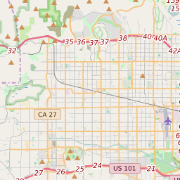
ZIP Code 91362 - Thousand Oaks Map and Data

Map of ZIP Code 91362 Border

Official Zip Code NameThousand Oaks
Zip Code StateCalifornia
Zip Code TypeNon-Unique
Primary County: Ventura
Secondary County: Los Angeles
Area Code820 / 805
Current Population:36045
Racial Majority: 71.7%
Public School Racial Majority:White 59.4%
Unemployment Rate:2.4%
Median Household Income$106343
Average Adjusted Gross Income$174830
School Test Performance:Excellent
Average Commute Time26.3 Minutes
Time Zone:Pacific Daylight Time
Elevation Range1011 - 1624 ft.
Area19 Sqm.
Coordinates(Y,X)34.19251200, -118.81915300

Zip Code 91362 Profile

ZIP Code 91362 is located in the state of California in the Reno metro area. ZIP code 91362 is primarily located in Ventura County. Portions of 91362 are also located in Los Angeles County. The official US Postal Service name for 91362 is THOUSAND OAKS, California. Portions of ZIP code 91362 are contained within or border the city limits of Thousand Oaks, CA, Westlake Village, CA, Simi Valley, CA, and Agoura Hills, CA. ZIP code 91362 is within area code 805, area code 818 and area code 747. 91362 can be classified socioeconically as a Middle Class class zipcode in comparison to other zipcodes in California.

The current unemployment level in 91362 is 2.4% which is lower than the current county unemployment level of 5.8% and is lower than the current state unemployment at 3.7% and lower than the current national unemployment rate at 3.7%.

According the 2010 US Census, the population of 91362 increased to 36045 from 33039 over the past 10 years. The majority ethnicity residing in 91362 is while the majority ethnicity attending 91362 public schools is White. 19.7% of students in 91362 public schools receive or are eligible to participate in free or reduced lunch programs.

20142010Change(+/-)
 White 25498 71.7% 25961 -2%
 Black Or African American 510 1.43% 472 +8%
 Hispanic 5194 14.6% 5376 -3%
 American Indian Or Alaskan Native 11 0.03% 46 -76%
 Asian 3348 9.41% 3206 +4%
 Native Hawaiian & Other Pacific Islander 38 0.11% 28 +36%
 Other Race 68 0.06% 68 -68%
 Two Or More Races 888 2.65% 888 +6%

Zip Code 91362 Race/Ethnicity

 White 59.4%
 Black Or African American 2%
 Hispanic 22%
 Asian 11.4%
 Hawaii/Pacific Islander 0.3%
 American Indian Or Alaskan Native 0.4%
 Two or More Races 4.3%

Zip Code 91362 Public School Race/Ethnicity Profile

20102000
Total Population3604533039
Male Population48.70%
Female Population51.30%
Total Households13563
Test Score PerformanceExcellent
Percentage of Students Eligible For
Free or Reduced Lunch
19.7%
Percentage of Public Schools with
Title 1 Status
28.6%
Median Household Income$106343
Income Under $50K Per Year21.70%
Income $50K to $100K Per Year24.90%
Income Above $100K Per Year53.30%
91362 US Congressional District
DistrictRepresentativeParty Affiliation
California District 26Julia BrownleyDemocrat
California District 25Katie HillDemocrat
Related Maps: Map of All California Congressional Districts

Average Real Estate Asking Price$930536
Average Real Estate Sale Price$705229
Current Unemployment Level 2.4%
Previous Month Unemployment Level2.8%
Unemployment Level 1 Year Ago3.4%
2012 Hardiness ZoneZone 10b: 35F to 40F
1990 Hardiness ZoneZone 10b: 35F to 40F
Köppen Climate ClassificationCsb - Warm-Summer Mediterranean Climate
Ecoregion
Average First Frost DatesDecember 21 - 31
Average Last Frost DatesJanuary 21 - 31

Zip Code 91362 Annual Climate Data

JanFebMarAprMayJunJulAugSepOctNovDecAnnual
Avg Min Temp (°F)41424346505457585650444148
Avg Max Temp (°F)67697075778288898681736877
Avg Precip (In.)4.184.152.991.07.3.05.03.04.21.41.592.3317.35
Core Based Statistical
Area (CBSA)
Oxnard-Thousand Oaks-Ventura, CA
CBSA Type91362
CBSA Population825436
Time ZonePacific Daylight Time
IANA Time ZoneAmerica/Los_Angeles
Follows DSTYes
GMT Difference-8 Hours
Downtown Thousand Oaks