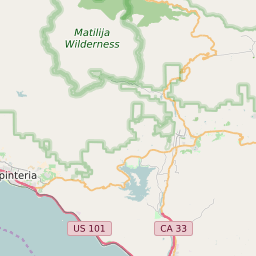
ZIP Code 93022 - Oak View Map and Data

Map of ZIP Code 93022 Border

Official Zip Code NameOak View
Zip Code StateCalifornia
Zip Code TypeNon-Unique
Primary County: Ventura
Area Code820 / 805
Current Population:6106
Racial Majority:White 69.54%
Public School Racial Majority:White 52.8%
Unemployment Rate:2.6%
Median Household Income$73223
Average Adjusted Gross Income$81980
School Test Performance:Below Average
Average Commute Time28 Minutes
Time Zone:Pacific Daylight Time
Elevation Range682 - 682 ft.
Area3 Sqm.
Coordinates(Y,X)34.40387900, -119.29834000

Zip Code 93022 Profile

ZIP Code 93022 is located in the state of California in the Reno metro area. ZIP code 93022 is primarily located in Ventura County. The official US Postal Service name for 93022 is OAK VIEW, California. Portions of ZIP code 93022 are contained within or border the city limits of Oak View, CA, Mira Monte, CA, . The area code for ZIP code 93022 is 805. 93022 can be classified socioeconically as a Middle Class class zipcode in comparison to other zipcodes in California.

The current unemployment level in 93022 is 2.6% which is lower than the current county unemployment level of 5.8% and is lower than the current state unemployment at 3.7% and lower than the current national unemployment rate at 3.7%.

According the 2010 US Census, the population of 93022 decreased to 6106 from 6495 over the past 10 years. The majority ethnicity residing in 93022 is White while the majority ethnicity attending 93022 public schools is White. 61.9% of students in 93022 public schools receive or are eligible to participate in free or reduced lunch programs.

20142010Change(+/-)
 White 4916 69.54% 4258 +15%
 Black Or African American 19 0.27% 16 +19%
 Hispanic 1722 24.36% 1589 +8%
 American Indian Or Alaskan Native 124 1.75% 54 +130%
 Asian 97 1.37% 70 +39%
 Native Hawaiian & Other Pacific Islander 0 0% 2 -100%
 Other Race 13 0% 13 -100%
 Two Or More Races 104 2.7% 104 +84%

Zip Code 93022 Race/Ethnicity

 White 52.8%
 Black Or African American 0.3%
 Hispanic 44.5%
 Asian 0.8%
 Hawaii/Pacific Islander 0.3%
 American Indian Or Alaskan Native 1.1%
 Two or More Races 0.3%

Zip Code 93022 Public School Race/Ethnicity Profile

20102000
Total Population61066495
Male Population50.10%
Female Population49.90%
Total Households2212
Test Score PerformanceBelow Average
Percentage of Students Eligible For
Free or Reduced Lunch
61.9%
Percentage of Public Schools with
Title 1 Status
100.0%
Median Household Income$73223
Income Under $50K Per Year32.30%
Income $50K to $100K Per Year35.10%
Income Above $100K Per Year32.60%
93022 US Congressional District
DistrictRepresentativeParty Affiliation
California District 26Julia BrownleyDemocrat
Related Maps: Map of All California Congressional Districts

Average Real Estate Asking Price$663833
Average Real Estate Sale Price$352492
Current Unemployment Level 2.6%
Previous Month Unemployment Level3.0%
Unemployment Level 1 Year Ago4.3%
93001 - Ventura
93023 - Ojai
Oak View, CA
Mira Monte, CA
2012 Hardiness ZoneZone 9b: 25F to 30F
1990 Hardiness ZoneZone 9b: 25F to 30F
Köppen Climate ClassificationCsb - Warm-Summer Mediterranean Climate
Ecoregion
Average First Frost DatesDecember 1 - 10
Average Last Frost DatesFebruary 21 - 28

Zip Code 93022 Annual Climate Data

JanFebMarAprMayJunJulAugSepOctNovDecAnnual
Avg Min Temp (°F)39414345495356565449423847
Avg Max Temp (°F)66686973768286878580726776
Avg Precip (In.)4.064.563.53.95.35.07.03.08.35.521.42.3918.27
Core Based Statistical
Area (CBSA)
Oxnard-Thousand Oaks-Ventura, CA
CBSA Type93022
CBSA Population825436
Time ZonePacific Daylight Time
IANA Time ZoneAmerica/Los_Angeles
Follows DSTYes
GMT Difference-8 Hours
List of High Schools in Zipcode 93022
Ventura High SchoolVentura
List of Middle Schools in Zipcode 93022
De Anza Middle SchoolVentura