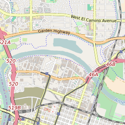
95833 can be classified socioeconomically as Lower Middle Class class compared to other ZIP Codes in California based on Median Household Income and Average Adjusted Gross Income. The majority race/ethnicity residing in 95833 is White. The majority race/ethnicity attending public schools in 95833 is Hispanic. The current unemployment level in 95833 is 5.0%.
| Population | 40,908 |
| Population Growth Rate | 0.00% |
| Population Density | 4,586 People per Square Mile |
| Total Households | 14,020 |
| Percentage High Income Households | 2.8% |
| Median Household Income (2021) | $74,677 |
| Average Adjusted Gross Income (2021) | $341,570 |
| Current Unemployment Rate (June 2025) | 5.0% |
| Majority Race/Ethnicty | White - 36.91% |
| Public School Majority Race/Ethnicty | Hispanic - 52.49% |
95833 Race/Ethnicty Breakdown
| Race/Ethnicty | Total | Percentage |
|---|
| White | 15,629 | 36.38% |
| Black | 5,664 | 13.19% |
| Hispanic | 15,626 | 36.38% |
| Asian | 5,013 | 11.67% |
| Native American | 409 | 0.95% |
| Hawaiian/Pac. Islander | 616 | 1.43% |
95833 Public School Race/Ethnicty Breakdown
| Race/Ethnicty | Total | Percentage |
|---|
| White | 555 | 11.21% |
| Black | 896 | 18.1% |
| Hispanic | 2,833 | 57.24% |
| Asian | 524 | 10.59% |
| Native American | 32 | 0.65% |
| Hawaiian/Pac. Islander | 109 | 2.2% |
95833 Educational Attainment Levels
| Highest Education Level Attained | Total | Percentage |
|---|
| Less Than 1 Year of College | 1,611 | 7.81% |
| Bachelor Degree | 4,888 | 23.68% |
| High School Diploma | 4,240 | 20.54% |
| No High School Diploma | 573 | 2.78% |
| GED or Alternate | 605 | 2.93% |
| 1 or More Years of College | 4,639 | 22.48% |
| Associates Degree | 2,164 | 10.49% |
| Masters Degree | 1,212 | 5.87% |
| Professional Degree | 433 | 2.1% |
| Doctorate Degree | 273 | 1.32% |